Kangshung Face, Tingri, Tibet · 12 days / 11 nights · Challenging (5/5) · max ~5,350 m (Langma La pass) · $300/day · $3,600 total per person
Three 8,000-metre giants, one legendary valley.
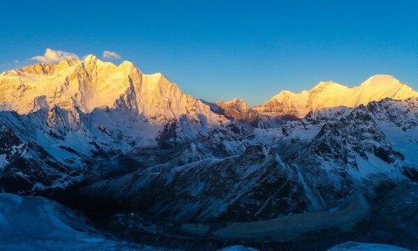
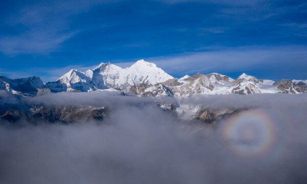
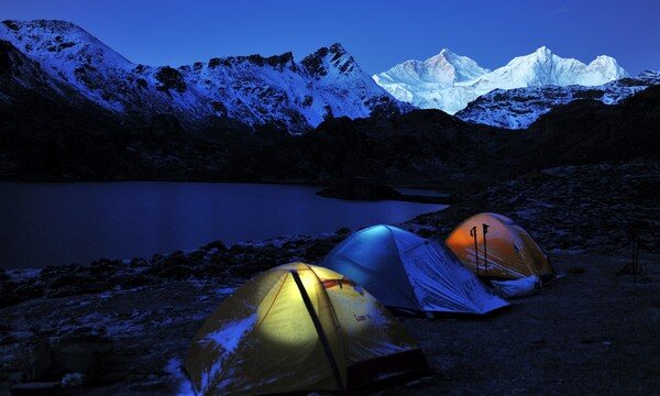
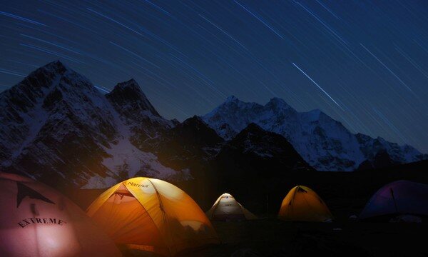
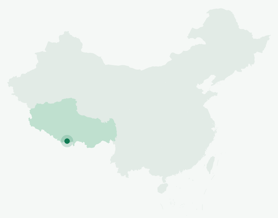
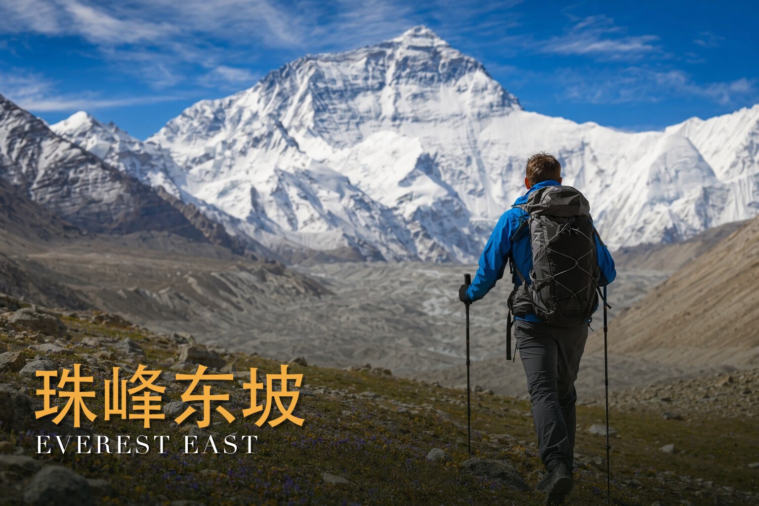
The Everest East Face trek—threading the Gama (Kangshung) Valley on the boundary of Dingri and Dinggye counties in Tibet's Shigatse prefecture—is routinely ranked among the ten greatest hikes on Earth, and it earns the title. This is the most cinematic high-altitude walk in the entire Himalaya: a journey that averages well above 4,000 metres and tops out at the Langma La pass (5,350 m), strung between snow passes by stretches of ancient forest, swaying greenery, dappled shade and chattering streams. The Gama Valley is celebrated as one of the most beautiful valleys in the world, and it shelters the largest tract of primeval forest anywhere in the Everest region.\n\nWhat sets this route apart is the company you keep. From its viewpoints you stand in the presence of three 8,000-metre titans at once—Everest (8,848 m), Lhotse (8,516 m, the world's fourth-highest, named the \"South Peak\" for sitting just three kilometres south of Everest) and Makalu (8,463 m, the world's fifth-highest, straddling the China–Nepal border northeast of the route). Glaciers spill from their flanks and the summits ignite gold at first light. Between the giants the land shifts constantly: alpine meadow gives way to old-growth forest, then to glacial moraine and frozen tundra where blue gentians, pale-lilac iris and white snow-lotus push through barren ground, and entire hillsides blaze with rhododendron in summer.\n\nThe walking is serious—rated five stars for both scenery and difficulty—but the rhythm is generous. After acclimatising in Lhasa and crossing the high plateau via Yamdrok Lake and Karola Glacier to Shigatse and on to Qudang, the trek proper begins at Yupa village. You climb to the lakeside camp of Xiaowucuo (4,700 m) beneath Xiaowu La, cross the pass at 4,950 m, and descend through the Xueruo Valley to Zhuoxiang—the climatic divide of the Gama Valley, where the vegetation suddenly thickens. From Tangxiang's meadow camp, pitched dead opposite three snow peaks, you push north to Ega, then make the spur up to Baidang (around 5,000 m) to stand almost beneath the east faces of Everest and Lhotse. The climax is Cuoxuerenma (4,950 m), a chain of six small lakes that form the finest natural amphitheatre on the east side of Everest—a mirror that catches Everest, Lhotse, Makalu and Chomo Lonzo in a single still surface. A full free day here lets you wait, in silence, for the moment the first light strikes the summits. The trek closes over the Langma La (5,350 m), the route's highest point, with a long descent to Lunzhulin village and the drive out to Dingri, before returning to Lhasa for a celebration dinner and trekking certificates.
Everest East Face (Kangshung) runs 12 days / 11 nights.
It's rated Challenging (5/5), topping out around ~5,350 m (Langma La pass). Reasonable hiking fitness and time to acclimatize to altitude are recommended.
The high point is around ~5,350 m (Langma La pass). Acclimatize gradually and take altitude-sickness precautions — consult your doctor before any high-altitude trek.
The best seasons are Summer (rhododendron bloom) and autumn (clear skies, still lakes mirroring the peaks).
English-speaking guide on request · or local guide + Inglite app for English support It's run by an independent, licensed local mountain operator, with Inglite supporting you in English the whole way.
Approximately $3600 per person ($300/day · $3,600 total). You arrange payment directly with the licensed local operator — Inglite never collects payment.
This trek is operated by an experienced, licensed local Tibet mountain outfitter, with professional high-altitude photography leaders and 8,000-metre-grade guides at an industry-leading 1:6 ratio. English-language support is provided throughout via the Inglite app and your guide.
Run by an independent, licensed local operator. You arrange payment with the operator directly — Inglite connects you and never collects payment. Outdoor travel carries inherent risks; travel insurance with high-altitude and evacuation cover is required. Booking & refunds · Terms
— or send a request below —
✅ Request received! Reference
We reply within 24h. Fastest: message us on WhatsApp and mention your reference.
Chat on WhatsAppNobody quite finds the words for the first morning the clouds lift off the east wall. You don't climb Everest here — you walk twelve days, eleven of them under canvas, to stand in a green river valley and look up at the mountain's least-seen side: the Kangshung Face, a wall of hanging ice and dark rock that climbs straight out of the meadows in front of you. It is hard, honestly hard — five out of five, days strung above 4,500 metres, a high pass near 5,350. The altitude is the real test, not the trail. Come in summer and the rhododendrons are in flower and the meadows are green; come in autumn and the skies turn glass-clear and the lakes lie so still they hold the peaks upside down. Either way, you come as a guest.
The Kangshung Face is Everest's east face — the Tibetan side — and it is the largest and most remote of the mountain's three great walls. It rises roughly 3,350 metres from its base on the Kangshung Glacier to the summit, spreads about three kilometres wide where it meets the ice, and it sits six or seven days' walk from the nearest road. That distance is the whole point: almost nobody sees this face, and to be beneath it you have to earn the ground on foot.
The glacier at its foot feeds the Kama Chu — the Kama, or Gama, River — which runs east down the valley you follow. This is high Himalaya, yet the valley is improbably lush. As the ice has drawn back, willow, juniper and rhododendron have colonised the ground it left, and in season the meadows are thick and green. You walk a green corridor with the highest mountains on earth standing over it.
And what stands over it is extraordinary. From this one valley you can see three of the world's six highest peaks at once: Everest itself, Lhotse (the fourth highest, standardly given as 8,516 m), and Makalu (the fifth, 8,485 m), with the slender, elegant spike of Chomo Lonzo (7,804 m) for company. Makalu lies about nineteen kilometres south-east of Everest; Chomo Lonzo stands roughly five kilometres north-north-east of Makalu. To have them all in a single field of view, from a meadow, is a thing the Himalaya almost never offers.
There is one more strangeness worth carrying in your head as you walk. The rock at the very summit, two vertical miles above the valley floor, is marine limestone of Ordovician age — an old seafloor — and it carries the fossils of sea creatures: trilobites, crinoids, ostracods. Just below it sits the metamorphosed band climbers call the Yellow Band, and the summit limestone lies above a low-angle fault, the Qomolangma Detachment. The roof of the world was once the bottom of an ocean, lifted here by the slow collision of India and Asia.
Westerners came late to this valley, and when they came they were led. In 1921, during the first British reconnaissance of Everest, George Mallory and Guy Bullock became the first Westerners to see and survey the Kangshung Face. Local Tibetan yak herders guided them over the Langma La — the same high pass this trek crosses — and down into the Kama Chu's rhododendron forests. Mallory thought the scenery sublime, and judged the face above it unclimbable. His verdict has been quoted ever since: "other men, less wise, might attempt this way... but, emphatically, it was not for us."
It would be the last of Everest's three faces to be climbed. A 1981 American attempt, led by Blum and Reichardt (with Edmund Hillary and John Roskelley among the party), reached around 7,000 metres before retreating from severe avalanche danger. The first ascent came on 8 October 1983, by an American expedition led by James Morrissey: Momb, Buhler and Reichardt reached the summit that day, with three more — Lowe, Reid and Cassell — the next.
Then, in May 1988, a small American-British team climbed a new line on the South Buttress. Stephen Venables pushed on alone to the summit, becoming the first Briton to climb Everest without supplemental oxygen; his partners Webster and Anderson turned back at the South Summit. On the descent Venables bivouacked alone, in the open, near 8,600 metres — a night he survived and later set down in his book *Everest: Kangshung Face*.
To the people who live beneath it, this is not a trophy. The mountain is Qomolangma — Chomolungma — most often glossed as "Holy Mother" or "Goddess Mother." Tibetans hold it to be the seat of the goddess Miyolangsangma, one of the Five Long-Life Sisters, whose particular virtue is inexhaustible giving and who is depicted riding a tiger. Expeditions traditionally hold a puja, a ceremony of respect, before they set foot on her.
Walk this valley the way the people who herd yaks through it do. For Tibetans and Sherpas the passes and ridges around you are the homes of deities, not obstacles to be conquered. You are a guest in a sacred landscape — the Langma La you cross, the lakes you camp beside, the wall you have come to see. Carry that lightly but carry it: it changes how the place feels, and it is simply the truth of where you are.
The trek is honest about what it asks. Eleven nights of yak-supported tent camping. Day after day spent above 4,500 metres. No roads, no shops, no quick rescue. A high point on the Langma La near 5,350 metres, where Makalu fills the whole sky. The early days — the slow climb from Lhasa up through Shigatse, and the rest days written into the schedule — are not filler. They exist so your body can catch up with the altitude. The summary describes a high-Himalayan odyssey through the Gama (Kangshung) Valley to stand face-to-face with the east walls of Everest, Lhotse and Makalu, and that is exactly what the rhythm of the days delivers: patience first, then the wall.
You land in Lhasa and do almost nothing, on purpose. At 3,760 metres the first job is simply to breathe slowly, drink water, and let the city's altitude begin to do its quiet work on you.
A long road day west and a little higher, to Shigatse at around 3,800 metres. The driving is part of the acclimatisation, not a delay before it.
On toward Qudang, holding near 3,800 metres. The landscape opens out and empties; you are leaving the towns behind and edging toward the country where the walking begins.
The first real climb on foot. From Qudang you pass through Yupa village and gain nearly a kilometre of altitude to camp around 4,700 metres. This is the day your legs and lungs learn what the trek is.
Up over your first high pass near 4,950 metres, then a long descent to around 4,000 metres. A big day of up-and-over, and the kind of pass crossing the rest of the route will repeat.
A steadier day, climbing back up to about 4,550 metres at Tangxiang. The valley draws you deeper into the high country.
On to Ega, near 4,700 metres — a camp you will come to know, because you'll be back. The great peaks begin to assert themselves over the skyline.
A day out and back: up toward Baidang at around 4,950 metres, then down again to sleep at Ega. Climbing high and sleeping low like this is exactly how the body is meant to handle altitude, and it buys you the views without the cost of camping higher.
You move your camp up to Cuoxuerenma, near 4,950 metres — high, close to the heart of the valley, and your base for what comes next.
A day to rest, to wander, to let the altitude settle, and to wait on the weather. Up here a free day is not idleness; it is insurance, and on a clear afternoon it is a gift.
The big one. You climb to the Langma La, the high point near 5,350 metres, where Makalu rises straight in front of you — the same pass Mallory's Tibetan guides led him over a century ago — and then begin the long way out toward Qudang and on to Dingri.
The road back to Lhasa, watching the high country recede behind you, carrying the wall in your memory.
How remote is this, really? Very. The Kangshung Face sits six or seven days' walk from the nearest road, and for most of the trek there are no shops, no roads, and no quick way out. Everything is carried in, and the camps are supported by yaks.
What are the actual sleeping conditions? Eleven nights in tents, yak-supported, with most camps above 4,500 metres and a couple near 4,950. It is real high-altitude camping — cold nights, simple comforts — not lodge-to-lodge trekking.
Do I need permits, and can I arrange them myself? You need a Tibet Travel Permit plus extra permits for this restricted border zone, and they must be arranged through a licensed operator with a registered guide. You can't legally trek here independently, and you can't board transport to Lhasa without the permit.
How worried should I be about altitude? Take it seriously. The itinerary is built around acclimatisation — the slow gain from Lhasa through Shigatse, the climb-high-sleep-low day at Baidang, the free day at Cuoxuerenma — precisely because the route lives so high. Go up slowly, hydrate, tell your guide how you feel, and clear it with your doctor beforehand if you have any relevant medical history.
Will I actually see Everest, Lhotse and Makalu? From the Gama Valley, yes — this is one of the rare places on earth where three of the six highest peaks stand in a single view, with Chomo Lonzo alongside. Mountains make their own weather, though, which is why the free day and clear-skied autumn exist: to give the wall a chance to show itself.
How fit do I need to be? Fit enough for long days on foot at altitude, day after day, including pass crossings near 4,950 metres and the 5,350-metre Langma La. The terrain is non-technical, but the sustained height and the camping make this a genuinely demanding trek, rated five out of five.