Walking a Circle Around the Mountain Nobody Climbs
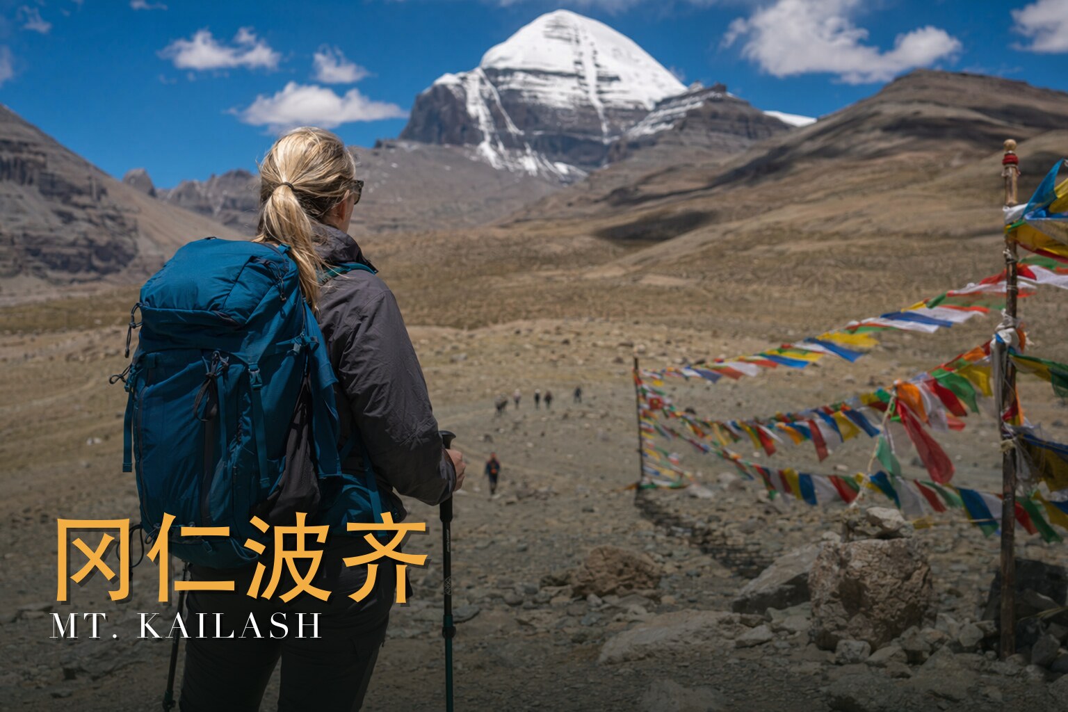
I have walked many high places, but only one where the whole point is to *not* reach the summit. For eleven days I move toward Mount Kailash and then around it — never up it — because no one ever has, and no one is allowed to, out of respect for what it means. This is a challenging journey: ten nights, three hard days of actual kora on foot, and a high point near 5,630 metres at the Drolma La, where the air is thin enough to make a strong walker humble. Come between May and October; the rest of the year the passes belong to the snow. What moves me here is not difficulty for its own sake. It is that millions have walked this same loop for a thousand years, each for their own reason, and the mountain has watched all of them with the same silence. You join that line of footprints. You do not conquer anything. You complete a circle.
The land
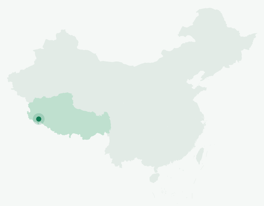
Mount Kailash rises to 6,638 metres (21,778 feet) in the Gangdise Range of the Transhimalaya, on the western Tibetan Plateau in Ngari Prefecture — out near the trijunction where China, India and Nepal meet. It stands apart from the main Himalaya, a distinct four-sided peak that does not lean on its neighbours for grandeur. Up close you see why it has unsettled and awed people for so long: thick conglomerate rock sitting on a granite base, the conglomerate running from roughly 4,700 metres to the very top, left exposed when the last Quaternary ice sheets retreated about ten thousand years ago.
This is also one of the great water-towers of Asia. Four mighty rivers — the Indus, the Sutlej, the Brahmaputra (Yarlung Tsangpo) and the Karnali — all rise within about sixty kilometres of this one peak. Stand near Kailash and you are standing near the birthplace of the rivers that feed a continent.
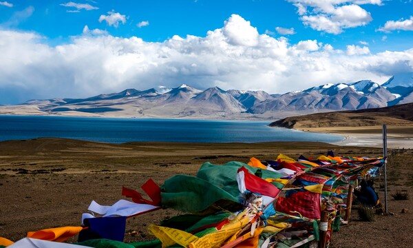
Below the mountain lie its two famous lakes, and the contrast is almost too neat to be accidental. Round, sweet-water Manasarovar sits at around 4,600 metres — one of the highest large freshwater lakes in the world, with a shoreline some 88 kilometres around. Beside it, crescent-shaped Rakshastal is saline, dark, supporting almost no plant or animal life at all — the "ghost lake." A thin channel, the Ganga Chhu, links the two, yet pilgrims will tell you the waters never truly mix: one for light, one for shadow.
A short history
Kailash has never been climbed, and that is part of its history rather than an accident of it. There are no known successful ascents, and climbing is strictly prohibited. Reinhold Messner reportedly declined the chance in the mid-1980s; in 2001 permission was denied to a Spanish team. Earlier surveyors — Ruttledge in 1926, Wilson in 1928, Tichy in 1936 — each looked at the peak and judged it, in effect, unclimbable. So the summit remains untouched, by choice as much as by terrain.
The mountain's deepest story is a spiritual one. The Tibetan saint Milarepa (c. 1052 – c. 1135) is said to have won Kailash for Buddhism by reaching its summit on the rays of the rising sun, defeating the Bon practitioner Naro Bönchung in a contest of power.
Further west, the route brushes against a lost civilisation. Around Zanda stand the cliff-cut ruins of the Guge Kingdom, a Buddhist realm that endured from the tenth century until its fall in 1630, with the nearby Tholing monastery still holding the memory of that vanished world. And toward the journey's start, Shigatse's great Tashilhunpo Monastery, founded in 1447, remains the seat of the Panchen Lama.
The people & their mountains
To Tibetans and to millions beyond, Kailash is not scenery — it is sacred geography, holy at once to four faiths. Hindus revere it as the abode of Shiva, who dwells here with Parvati and their sons; Buddhists hold it deeply sacred; for Jains it is where the first Tirthankara, Rishabhadeva, found liberation; and for the old Bon faith it is the seat of the sky goddess Sipaimen and the centre of the ancient Zhang Zhung empire. Many traditions also identify it with Mount Meru, the axis of the world itself.
The pilgrimage is the kora — the loop around the mountain, about 52 to 53 kilometres in all. Buddhists, Hindus and Jains walk it clockwise; the Bonpo walk the other way. One full circuit is said to cleanse the sins of a lifetime, and tradition holds that 108 circuits bring liberation. People come on foot, some measuring the whole loop in full-body prostrations, and the ordinary trekker walks humbly among them.
The twin lakes carry their own lore. Manasarovar is the bright "mother" water; Rakshastal is tied to the demon-king Ravana, who is said to have performed his penance to Shiva on its dark crescent shore.

Walking the route
The honest truth is that the scenery has to be earned, and the itinerary earns it the right way — by climbing slowly, sleeping low, and saving the holy mountain for when your body is ready. The first days are a long approach across the plateau; the kora itself, the heart of everything, falls in the middle. By the time the trail bends to face the north wall of Kailash, you have already given the altitude its due.
Day 1 — Arrive in Lhasa (3,650 m)
I land and do almost nothing, on purpose. At 3,650 metres the only sensible plan is to rest, drink water, and let the body begin to understand where it is.
Day 2 — Lhasa – Zhaji Temple – Tashilhunpo Monastery – Shigatse (3,800 m)
West toward Shigatse, with a pause at the magnificent Tashilhunpo Monastery (1447), seat of the Panchen Lama — a first, grounding immersion in Tibetan Buddhism before the high country.
Day 3 — Shigatse – Lhatse – Gawu La Pass (5,210 m) – Everest Base Camp (5,200 m)
A big day that crests the Gawu La at 5,210 metres and ends beneath the north face of Everest, near 5,200 metres. The plateau begins to show its true scale.
Day 4 — Everest Base Camp – Shishapangma – Peiku Tso – Saga (4,485 m)
Past Shishapangma — the only 8,000-metre peak entirely inside Tibet — and the waters of Peiku Tso, dropping to Saga at 4,485 metres for the night.
Day 5 — Saga – Mayoumu La Pass (5,200 m) – Lake Manasarovar – Rakshastal – Darchen (4,800 m)
Over the Mayoumu La at 5,200 metres and into the holy heart of the journey: sweet, round Manasarovar and dark, crescent Rakshastal side by side, then on to Darchen at 4,800 metres, the gateway to the kora.
Day 6 — Darchen – Chuku Monastery – Drira Phuk Monastery (5,100 m)
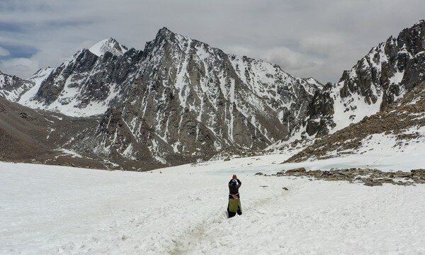
The kora begins. The trail bends to face the sheer north wall of Kailash and reaches Drira Phuk, near 5,100 metres — one of the highest monasteries in the world, with the peak filling the sky in front of it.
Day 7 — Drira Phuk – Sky Burial Site – Drolma La Pass (5,630 m) – Darchen (4,800 m)
The hardest day, and the highest. The climb passes Shiva-tsal, a sky-burial ground at around 5,330 metres where pilgrims leave a scrap of clothing or a lock of hair — symbolically dying, to be reborn as they crest the Drolma La at 5,630 metres, the highest point of the whole journey. There is no being casual up here; you keep moving, then you go down to Darchen.
Day 8 — Darchen – Longka La Pass – Zanda Clay Forest – Guge Kingdom – Zanda (3,600 m)
The kora complete, I turn west over the Longka La into the eroded "clay forest" of Zanda — wind-carved earth towers over an old lakebed — and the cliff-cut ruins of the Guge Kingdom, ending low at Zanda, 3,600 metres.
Day 9 — Zanda – Payang (Colorful Beach) – Gongzhuo Lake – Saga (4,485 m)
A long return across the plateau by way of Payang's colourful beach and Gongzhuo Lake, back to Saga at 4,485 metres.
Day 10 — Saga – Lang Lake – Shigatse (3,800 m)
Eastward again, past Lang Lake, retracing the high road back to Shigatse at 3,800 metres.
Day 11 — Shigatse – Gyantse – Karola Glacier – Yamdrok Tso – Lhasa
A fitting last day: Gyantse, the ice of the Karola Glacier, and the long turquoise sweep of Yamdrok Tso before the road drops back into Lhasa.
Know before you go
- When to come: May to October. The passes — above all the Drolma La at 5,630 metres — are only reliably open and walkable in these months; outside that window, snow and wind effectively close the route.
- How hard: Challenging (4.5 out of 5). The difficulty here is altitude, not technical climbing. You sleep repeatedly above 4,000 metres and cross several passes over 5,000, peaking at 5,630 metres. The itinerary acclimatises you deliberately through Lhasa and Shigatse before the kora, which matters enormously — but altitude sickness is real, the headaches are real, and the only cures are to ascend slowly and descend when needed. If you have heart, lung, or blood-pressure conditions, consult your doctor well before committing.
- Guide or solo: Not a choice here. Ngari is a permit-controlled region, and no foreigner may walk it alone. A licensed local operator, a guide, and a full stack of permits are mandatory. Beyond the legal requirement, a guide is your margin of safety: language, navigation across a vast and remote plateau, and — most importantly at these altitudes — the judgment and means to get you down and out if your body says stop.
FAQ
Do I actually climb Mount Kailash? No. No one climbs Kailash — it has never been summited and ascent is forbidden out of respect for its sacredness. The trek is the kora, a roughly 52-kilometre loop *around* the mountain. The walking high point is the Drolma La pass at 5,630 metres.
How much of the eleven days is on foot? The dedicated kora is done in about three hard days from Darchen (around Days 6 and 7 here, with the high pass on Day 7). The surrounding days are a high-plateau journey by road that acclimatises you and carries you past Everest's north face, the holy lakes, and the Guge ruins. The walking is concentrated where it matters most.
Will I get altitude sickness? Possibly — most people feel *something*, from headache to breathlessness, especially around the Drolma La. The itinerary is built to acclimatise you gradually, which greatly reduces the risk, but it cannot eliminate it. Go slow, hydrate, tell your guide how you feel, and be willing to turn back or descend. Consult your doctor before the trip if you have any relevant medical conditions.
Which way do I walk the kora, and does it matter? Clockwise — the direction followed by Buddhist, Hindu and Jain pilgrims. Followers of the Bon faith walk it counter-clockwise. You will likely share the trail with pilgrims going both ways, some prostrating the entire circuit; walk respectfully among them.
Why are there two lakes that look so different? Manasarovar is round, sweet, freshwater and holy; Rakshastal is crescent-shaped, saline and nearly lifeless. They sit side by side, joined by a thin channel, the Ganga Chhu — yet tradition holds their waters never mix. Pilgrims read them as light and shadow, and seeing them together is one of the quiet highlights of the route.
Do I really need a guide and permits, or can I arrange it loosely? You genuinely need them. Ngari is permit-controlled and foreigners cannot trek it independently; a licensed local operator, a guide, and the correct permits are required by law. In practice they are also what keeps you safe across such remote, high terrain — for navigation, for the local language, and for getting help if altitude or weather turns against you.