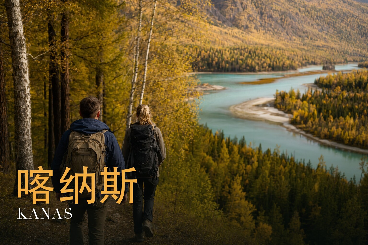
Where the Larch Turns Gold and the River Runs North
I have walked into China's far-northwest corner, where Xinjiang's Altai mountains lean against Russia, Kazakhstan and Mongolia, and I keep going back. This is a sub-Siberian world that feels nothing like the rest of the country: dark taiga, log-cabin villages, water the colour of jade. We give it eight days — eight days, seven nights, roughly 80 kilometres on foot — and I have come to think of that as the right amount of time, not a day too few. The walking is moderate, about a 2.5 out of 5; the high point sits under 2,000 metres, so it is your knees and the weather that test you, not the thin air. Come in autumn, from mid-September into early October, when the larch and birch blaze gold and orange against the conifers, often under a low morning mist. That is the whole point. That is why it moves me every time.
The land
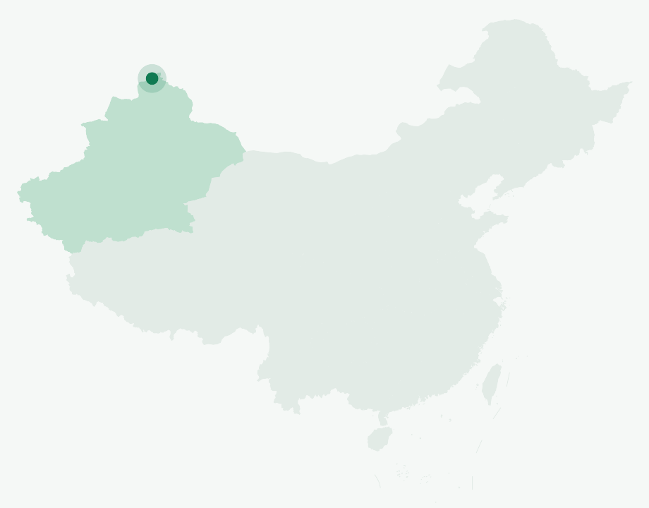
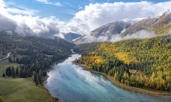
Kanas Lake is the heart of all of this — a long crescent of glacier-fed water in the Altai Mountains, at the far-northern tip of Xinjiang in Burqin County, Altay Prefecture, close to where China meets Russia, Kazakhstan and Mongolia. It is a moraine-dammed lake: ice carved this valley, then the ice left behind a wall of its own debris that holds the water in. The figures are striking. It is the deepest glacial-moraine-dammed lake in China, with a maximum depth of about 188 metres and an average depth of around 120 metres, spread over some 45 square kilometres of surface. Its elevation sits in the range of roughly 1,340 to 1,374 metres, depending on which source you trust.
I tell people not to fix the lake's age too precisely. The basin was glacially eroded long ago — before some 28,000 years ago — and the present lake took its modern shape thousands of years back, by at least around 6,800 years ago. You will read a rounder figure elsewhere; I keep to the dated "thousands of years," because that is what the science actually supports.
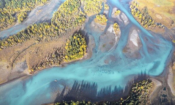
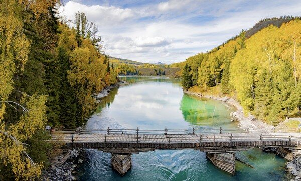
The colour is never the same twice. Turquoise, jade-green, a milky grey-blue — it shifts with the season and the light, and the cause is glacial rock flour, the fine silt that glaciers grind from stone and carry into the water. Treat any "this month it is exactly this colour" claim as poetry, not fact.
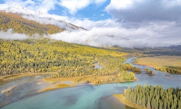
What leaves the lake has an extraordinary destiny. The outflow joins the Hemu and Burqin rivers and becomes the Irtysh — the only river in all of China that drains to the Arctic Ocean, by way of Kazakhstan and then the Ob in Russia. Far to the north stands Friendship Peak (Youyi Feng), at about 4,360 metres — sources split between 4,356 and 4,374 — the highest summit of the Chinese Altai, its top split by the border with Mongolia, one of five Tavan Bogd peaks. Its glaciers help feed the lake you are walking beside.
The forest is true Siberian taiga: larch, birch, spruce and fir. This is a southern outlier of the great boreal belt, and in autumn it does something the rest of China cannot quite match.
A short history
Kanas drew wider outside attention in the 1980s, and today it carries China's top AAAAA scenic rating along with geopark, forest-park and nature-reserve designations. (You may see a precise upgrade timeline quoted year by year; I treat the current AAAAA status as confirmed and leave the exact dated path as reportedly so.)
The Guanyutai viewpoint has its own small history. The pavilion was first built in 1987 and reconstructed in 2009, set on Camel Peak at about 2,030 metres and reached by 1,068 steps. From up there the whole lake unrolls below you, several hundred metres down — the pavilion stands roughly 600-plus metres higher than the water.
And then there is the legend. The "Kanas Lake Monster" is a long-standing local tale. In 1985 the scholar Yuan Guoying and his students reported seeing very large fish in the lake, with sighting estimates of 10 to 15 metres long. Scientists most plausibly attribute these to giant taimen, a real and very large fish. I pass it on the way I received it: as living folklore with a reasonable biological explanation, not as a confirmed creature.
The people & their mountains
This is a land of the Tuvans, a small Turkic-speaking people — officially counted in China as Mongols — who have lived around Kanas for generations. Their world is built around three log-cabin villages, and the trek threads through them. Baihaba is a frontier village barely a few kilometres from the Kazakhstan border. The lakeside Kanas village sits beside the water. Hemu is the largest and most remote, and on a cold morning the wood-smoke rising over the cabins through the mist is the scene the painters come for.
Their beliefs layer Tibetan Buddhism over older shamanism and sky-worship. On the passes you will see ovoo — stone cairns — which are sacred; the mountains and the lake are sacred too. The Altai is also one of the oldest skiing cultures on Earth: petroglyphs in this region show figures on skis chasing game, thousands of years old. Walk through here as a guest. Do not climb on the cairns or treat them as photo props, and follow your guide's lead on what is and isn't yours to touch.
Walking the route
What I love about this traverse is how forgiving it is on the body and how generous it is on the eye. The high point stays under 2,000 metres, so you breathe easy; the real demands are distance, the big swings between day warmth and night cold, and weather that can turn. You are walking from village to village, lake to forest to pasture, with the gold light getting richer each day.
Day 1 — Arrival and gathering in Altay
We gather in Altay, the prefecture town, around 700–800 metres. A day to land, meet, sort permits and gear, and let the journey settle in your mind before the mountains start.
Day 2 — Altay to Burqin / Habahe to Baihaba Village
A long transfer northwest toward the border country, ending in Baihaba — a Tuvan frontier village of log cabins sitting close to the Kazakhstan line, the first place that truly feels like the Altai.
Day 3 — Baihaba Village to Kanas
We move from the frontier village toward the lake, the taiga thickening and the larch deepening in colour as we climb gently toward the Kanas valley at roughly 1,300–1,400 metres.
Day 4 — Kanas — relaxed exploration day
An easier day to explore the lakeside: the bays, the forest edges, and — for those with the legs — the 1,068 steps up to the Guanyutai pavilion at about 2,030 metres, where the whole turquoise lake opens out below.
Day 5 — Kanas to the Three Bays to Jiadengyu
We follow the river down past the famous Three Bays — the bends where the water coils through the forest — to Jiadengyu at the valley mouth, a day of moving water and turning leaves.
Day 6 — Jiadengyu to Beike pastures
We climb away from the valley floor onto the Beike pastures, open high meadow grazed by herders, the forest opening into long views.
Day 7 — Beike pastures to Hemu
A walk over to Hemu, the largest and most remote of the Tuvan villages, where wood-smoke and morning mist over the cabins make the scene people travel across the country to see.
Day 8 — Hemu to return to Altay
We leave Hemu and transfer back to Altay, the gold country falling behind us — the kind of last day you spend half-asleep against the window, already planning to return.
Know before you go
- When to come: Autumn, from mid-September into early October, for peak foliage — the few weeks when the larch and birch go gold and orange against the dark conifers. Expect low morning mist, and don't be surprised by the first snow of the year.
- How hard: Moderate, about 2.5 out of 5, over roughly 80 kilometres in eight days. The high point is under 2,000 metres, so altitude is genuinely not the main concern here — you should acclimatize naturally, and serious altitude sickness is unlikely at these elevations. The real challenges are daily distance, large day-to-night temperature swings, and changeable weather. Pack a genuine winter jacket even in "autumn." If you have heart, lung or other health concerns, consult your doctor before any multi-day mountain trek.
- Guide or solo: Go with a licensed local operator — not because the trail is fierce, but because this is a border zone and a national reserve. Baihaba and the frontier require permits, and much of the experience runs on reserve logistics rather than freelance wandering. A local lead also handles language with Tuvan and Mongol communities, navigation between villages, and any emergency or rescue coordination far from help. (For foreign clients, Inglite supports the trip in English.)
FAQ
Do I need permits, and can I just walk in on my own? Yes, you need permits — this is a border area and a protected reserve, and Baihaba in particular sits very close to the Kazakhstan frontier. Permits and reserve logistics are handled through a licensed local operator; freelance wandering across these zones is not how it works here.
How cold does it actually get? The headline risk is the swing. Days can be mild and bright, but mornings, evenings and high pastures get genuinely cold, and the first snow of the season can arrive in this window. Bring a real winter jacket, warm layers, gloves and a hat even though it's labelled autumn.
Will the altitude be a problem? Almost certainly not in the usual sense. The high point stays under 2,000 metres, so this is not a high-altitude trek and acute mountain sickness is unlikely. Fitness for daily distance matters far more than thin air. If you have underlying health conditions, check with your doctor before you go.
Is the walking technical? No. It's moderate, around 2.5 out of 5 — forest paths, river valleys, village-to-village stretches and open pasture. The difficulty is in the kilometres and the weather, not in scrambling or exposure.
Will I really see the autumn colours, or is it luck? Mid-September to early October is timed for peak foliage, which is exactly why we run it then. Nature keeps its own calendar, so the precise peak shifts year to year, but this window is your best chance at the gold larch, the mist and the turning birch.
Is the Kanas "lake monster" real? It's a much-loved local legend. Scientists most plausibly explain the old sightings as giant taimen, a genuinely large fish. Enjoy it as folklore with a believable natural basis — not as a confirmed creature.