The Garden Closest to the Sky: Three Days Through Nanjiluo
I have walked this route as a trekker and I lead it as a licensed local guide, and I still struggle to describe what Nanjiluo does to a person. You give it three easy days and two nights, round-trip from Lijiang, and somewhere along the way the scale of the place rearranges you. This is light trekking — gentle on the legs, generous on the senses — yet it carries you to the spine of the Hengduan Mountains, where the high lakes the Lisu call the tears God dropped on earth lie scattered across meadow and old forest. Come between August and December, when the air sharpens and the odds of a clear snow peak improve. I do not promise you the mountain gods will lift their cloud. I promise you the kind of three days that make you born free, and a little fearless.
The land
You are walking inside the UNESCO Three Parallel Rivers World Heritage Site, inscribed in July 2003 — a serial property of fifteen protected areas in eight clusters, some 1.7 million hectares, spanning elevations from 760 m to 6,740 m, with gorges plunging up to about 3,000 m. It holds more than 6,000 plant species and, by UNESCO's account, over half of China's animal species. This is the one place on earth where the Yangtze (here the Jinsha), the Mekong (Lancang) and the Salween (Nu) run side by side, parallel and close, through some of the deepest valleys in the world.
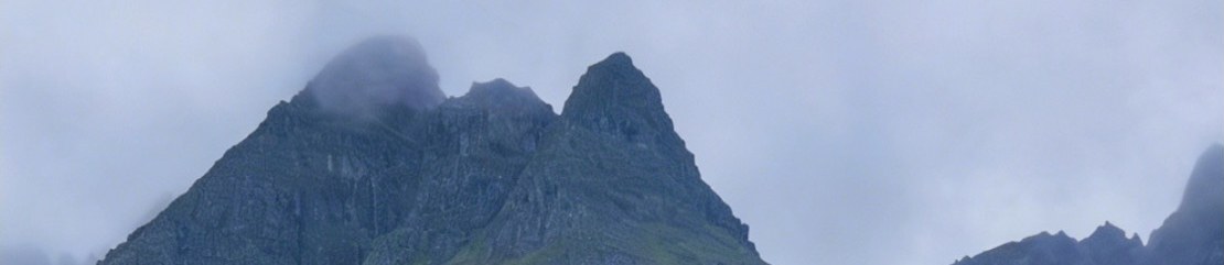
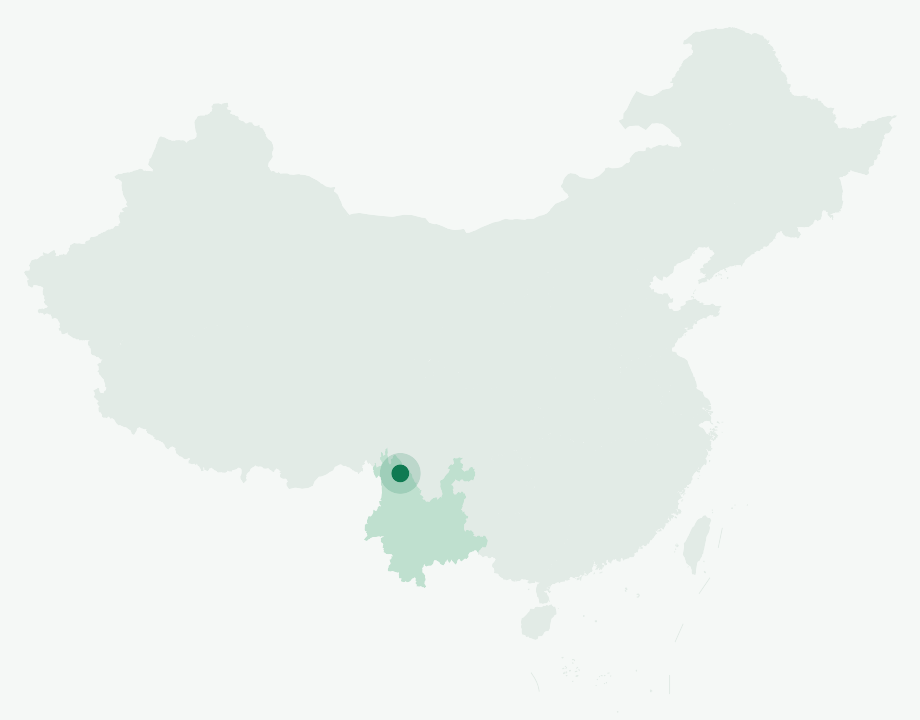
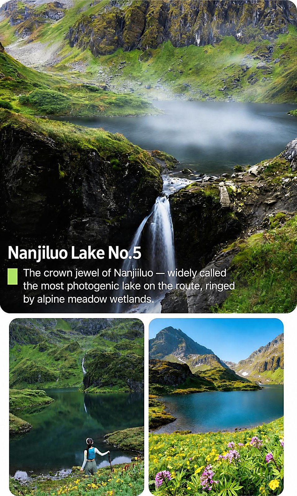
The hidden heart of these three days is Nanjiluo (南极洛), a lightly-trodden cirque of high lakes — around fourteen of them in the Chinese sources, a dozen-plus in any case — strung across alpine meadow and old-growth forest on the Biluo Snow Mountains. This range is the watershed that divides the Mekong from the Salween and draws the boundary between Weixi and Gongshan. Administratively, Nanjiluo sits in Badi Township of Weixi Lisu Autonomous County, in Diqing Tibetan Autonomous Prefecture. The trekking terrain rises from forest around 2,900 m and tops out near 4,480 m at the Biluo pass; the main summit, Laowoshan, stands at roughly 4,435 to 4,500 m.
A short history
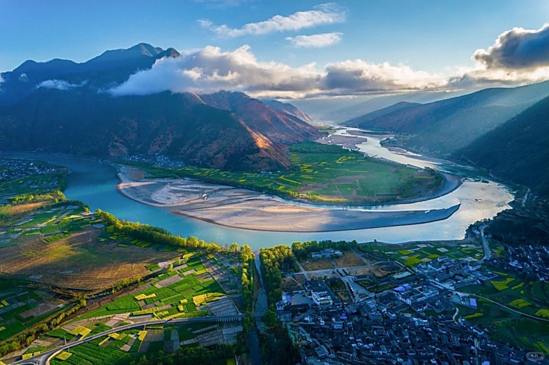
The valleys you thread are layered with history. At Shigu, the young Yangtze, hemmed in by mountains, swings back on itself in the dramatic U-turn known as the First Bend — the same crossing the Red Army forced in 1936. Further north, in the Mekong valley, stands the stone church at Cizhong. French priests of the Paris Foreign Missions first raised a church upstream at Cigu (Tsekou) in 1867; after it burned in the Tibetan revolt of 1905 it was rebuilt at Cizhong, crowned with a Chinese-style pavilion atop its bell tower. The last Western priest, Father Alphonse Savioz, left around 1951. A Catholic community — Tibetan, Naxi and Lisu — still gathers there to this day and still makes its own wine, a startling cultural seam in the high Tibetan borderland.
Above all looms Kawagebo, at 6,740 m the highest peak in Yunnan and one of the holiest mountains in Tibetan Buddhism. It has never been climbed. On 3 January 1991, a nighttime avalanche killed all seventeen members of a joint Japanese and Chinese expedition that had reached around 6,470 m — one of the deadliest disasters in mountaineering history. Climbing was banned outright in 2001. Pilgrims do not summit Kawagebo; they circle it on the kora, a roughly 150 km outer pilgrimage over seven passes, crossing from the Mekong side to the Salween, with Doker La at about 4,080 m and the high point at Shola near 4,800 m. In the Year of the Sheep, pilgrim numbers surge many times over.
The people & their mountains
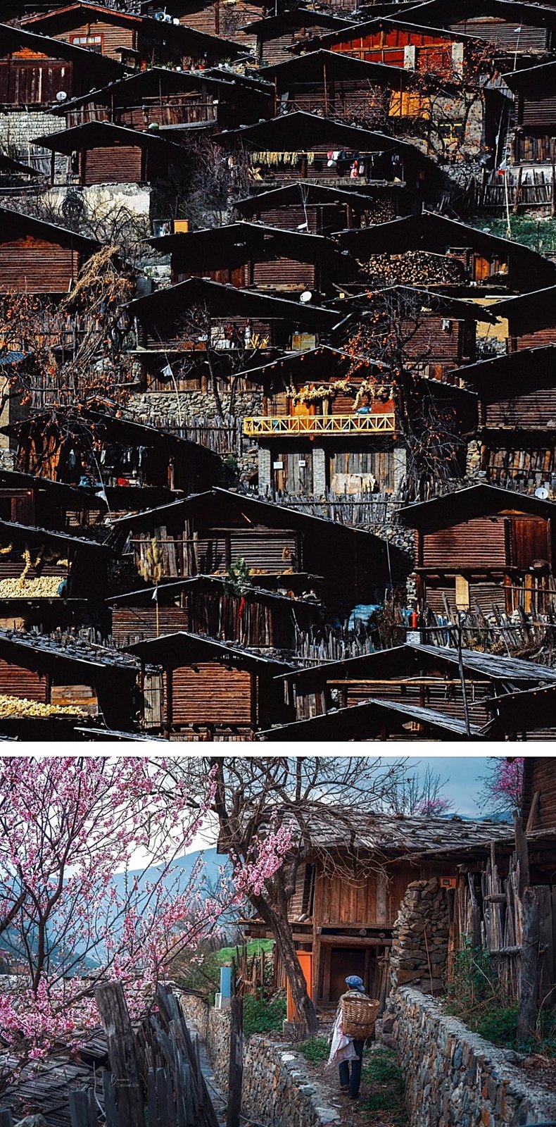
Weixi is the only Lisu Autonomous County in China, and the Lisu were traditionally animist and ancestor-honouring, shaman-led, crossbow-hunting people; many later embraced Christianity through the missionaries. Their new year is Kuoshi, and their festivals still carry crossbow contests and fire rituals. You begin and end among the Naxi of Lijiang, whose Dongba priests keep the world's only living pictographic script, and whose Old Town grew as a Tea Horse Road hub beneath Jade Dragon Snow Mountain.
What binds all these peoples is reverence for the mountains themselves. Kawagebo is not a summit to be conquered; it is a deity to be circled. On its flank the Mingyong Glacier slides down to about 2,650 m — one of the lowest-latitude glaciers in China, near 28.5°N — and is honoured as the mountain's tears. It is retreating, by roughly 200 m in four years. I ask every guest to carry the same posture the local people do: this is sacred ground, and the right answer to it is reverence, not conquest.
Walking the route
The walking itself is unhurried. Much of these three days is spent in a vehicle threading spectacular valley roads, with the trekking concentrated in the Nanjiluo immersion — soft underfoot, lake to lake, through meadow and forest. But the route as a whole climbs high, and the views you earn are out of all proportion to the effort. Here is how the three days unfold.
Day 1 — Lijiang → First Bend of the Yangtze → Weixi → Tonglo Lisu Mountain Village → Badi / Cizong
You leave Naxi country and drive north to the First Bend at Shigu, where the Yangtze loops back on itself, then climb west into Weixi and the Lisu highlands, pausing at Tonglo mountain village before reaching Badi or Cizong for the night — your threshold into the Biluo Snow Mountains.
Day 2 — Badi → Nanjiluo Deep Immersion Experience → Cizong Village → Meili Snow Mountain Viewpoint
This is the heart of it: the Nanjiluo deep-immersion walk among the high lakes and old forest, the "garden closest to the sky," before crossing toward Cizong and on to the Meili viewpoint, at around 3,300 m, facing Kawagebo across the gorge.
Day 3 — Meili Snow Mountain Viewpoint → Baimaxueshan (White Horse Snow Mountain) → Yila Grassland → Dukezong Ancient Town → Lijiang
A high day of farewell: you cross Baima (White Horse) Snow Mountain — a reserve sheltering some 3,000 endangered Yunnan snub-nosed monkeys, with a peak near 5,430 m and a road pass around 4,292 m — drop to the open Yila Grassland, and end in Shangri-La's Dukezong, the Tibetan "Moonlight City" rebuilt after its 2014 fire, before the return to Lijiang.
Know before you go
- When to come: Best from August to December. Kawagebo is famously shy — summer cloud hides it more often than not, so a clear "Sunshine Golden Mountain" sunrise is a gift, not a promise. Late autumn, roughly September through December, gives the best odds of a clean snow peak.
- How hard: Light and easy on the legs — but do not be fooled by "light trek." Although the immersion walking is gentle, the route as a whole climbs far above the day-to-day: the Meili viewpoint sits near 3,300 m and the Baima crossing reaches about 4,292 m, so there is real, if mild, high-altitude exposure. Plan to take the first days slowly to acclimatize, hydrate well, and ascend gradually. If you have a heart, lung, or blood-pressure condition, or any concern about altitude, consult your doctor before you travel.
- Guide or solo: I would not walk this one alone, and I say that honestly rather than as a sales line. Nanjiluo is lightly trodden, signage is minimal, and the high lake basins are easy to lose your bearings in. A licensed local lead guide handles navigation, reads the weather and the altitude in you, and — most importantly — can organize help or evacuation if something goes wrong in country where mobile signal is thin. For foreign guests, our operator works with Inglite for full English support, which removes the language barrier on permits, lodging and the road. This is also living sacred and cultural ground; a local guide is the difference between passing through and being welcomed.
FAQ
How fit do I need to be? Reasonably. The Nanjiluo walking is gentle and well within reach of anyone who hikes occasionally. The real demand is altitude, not distance — your body has to handle thin air at 3,300 m and a pass near 4,292 m, which is more about pacing and acclimatization than fitness.
Will I actually see Kawagebo? Maybe. It is one of the most cloud-shrouded big peaks anywhere, and clear sunrises are uncommon, especially in summer. Late autumn improves your chances, but no honest guide will guarantee it. Treat a clear morning as a blessing.
Do I need a permit or special documents? You are traveling in Diqing Tibetan Autonomous Prefecture, where some areas and lodgings have registration requirements. Our local operator arranges what is needed, and for foreign guests Inglite handles the English-language side of permits and bookings.
What should I pack for the altitude and weather? Layers above all: warm mid-layers and a windproof shell for the high viewpoints and passes, sun protection for strong high-altitude UV, sturdy footwear for meadow and forest, and any personal altitude medication your doctor recommends. Mornings at the viewpoints can be cold even in good season.
Is it appropriate to take photos at religious sites? Generally yes at the viewpoints and around villages, but always with respect. Inside the Cizhong church, around monasteries, and near pilgrims on the kora, ask first and follow your guide's lead. Remember Kawagebo is a deity to local people, not a backdrop.
How much of the trip is walking versus driving? A fair amount of each. The three days move through long, scenic valley drives connecting the highlights, with the concentrated trekking in the Nanjiluo immersion on Day 2. It is designed as a light trek, not an expedition, so the rhythm is gentle.