Mt. Siguniang, Sichuan · 5 days / 4 nights · Challenging (3.5/5) · $177/day · $885 total per person
Duration5 days / 4 nights
DifficultyChallenging (3.5/5)
Max altitude~4,660 m
Best seasonAutumn (mid- to late October) for snow peaks above fiery autumn colour; summer for cool, green high country
Group sizeSmall group (guide-to-guest ratio no lower than 1:8)
LanguageEnglish-speaking guide on request · or local guide + Inglite app for English support
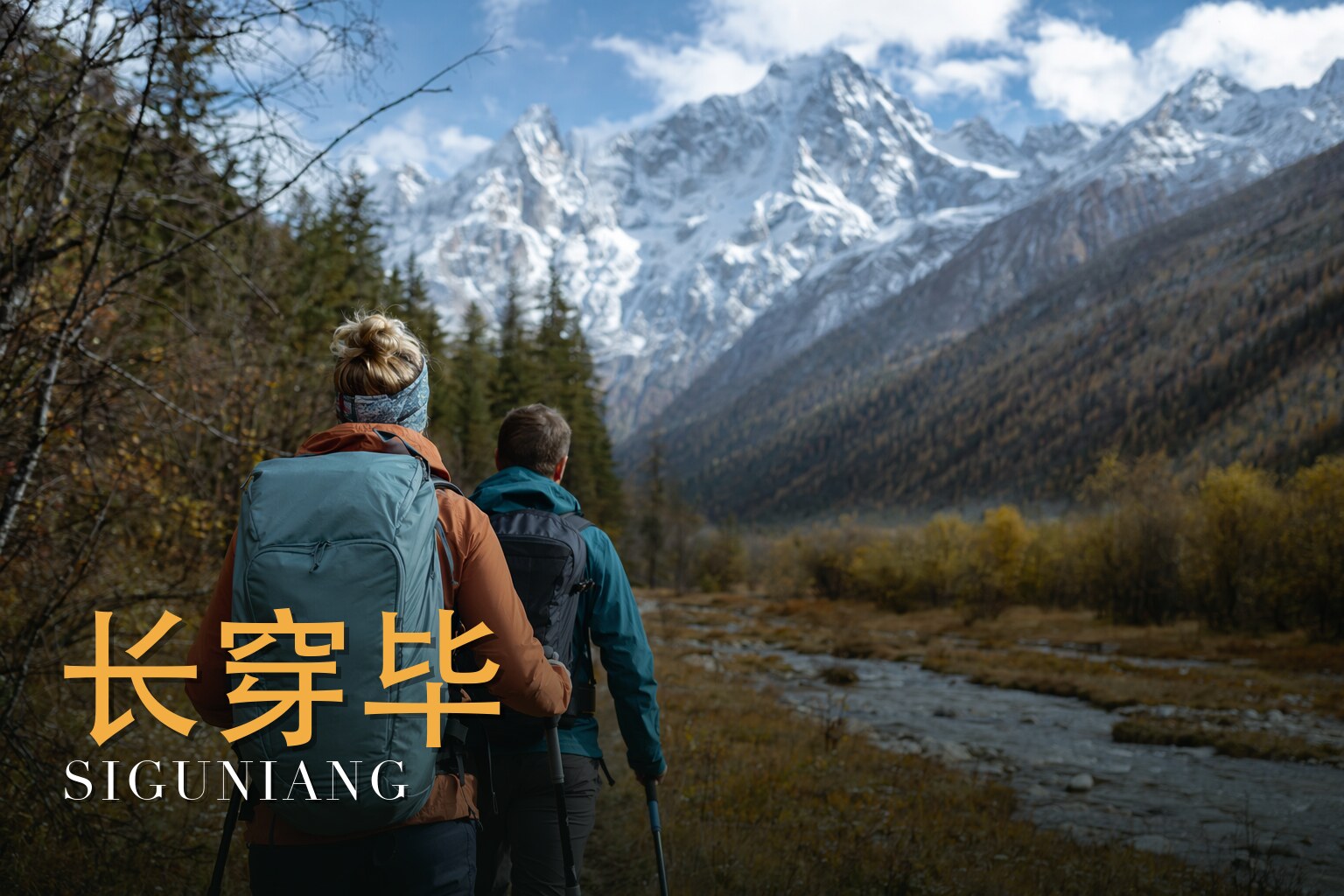
Cross the roof of the Four Sisters in autumn gold.
Highlights
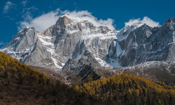
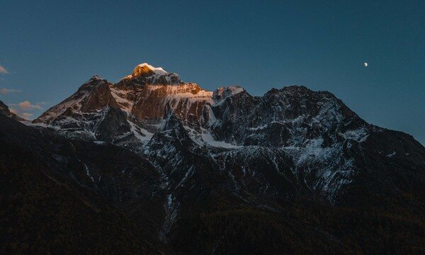
Mount Siguniang (Four Sisters, 四姑娘山) — a constant companion of glacier-draped granite peaks, crowned by Yaomei Feng (幺妹峰), the highest of the four sisters
Chazigou pass (叉子沟尾, ~4,660 m) — a pre-dawn climb that delivers you to the col at sunrise, with a vast sea of cloud and ranks of mountains unfurling below
Changping Valley (长坪沟) — a 29 km primeval corridor of ancient cypress trails, towering waterfalls, dry lake beds and weathered rock, rich in Jiarong Tibetan culture
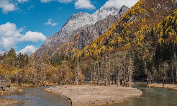
Bipenggou (毕棚沟) — the autumn-colour and giant-panda heartland of Miyaluo, the 'Little Switzerland of West Sichuan,' ablaze with maple and larch beneath snow peaks
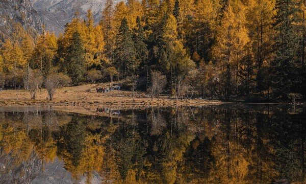
Autumn spectacle — in mid- to late October, red birch, sea buckthorn and maple set both valleys alight against fresh-snow summits
Ancient Tang Cypress Road — walking beneath thousand-year forest that carries the quiet weight of an old pilgrim route
Diverse alpine landscapes — snow mountains, glaciers, forest, meadow, waterfall and lake, all linked along a single crossing
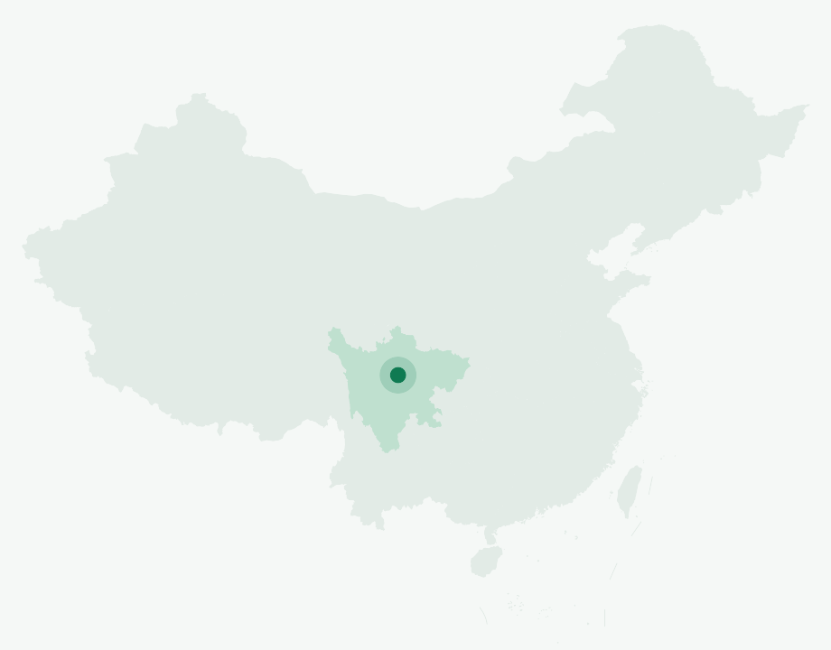
Where in China
📍 Sichuan Province · Mt. Siguniang, western China
What you'll do
The Changchuanbi traverse is one of China's ten classic long-distance treks, and it earns the title. Setting out from Changping Valley on the northeastern flank of the Siguniang (Four Sisters) massif, you walk for three days through old-growth forest, across glacier-fed streams and high meadows, over a 4,660 m pass, and down into Bipenggou, the autumn-colour heartland of the Miyaluo giant-panda habitat on the mountain's northern slope. The full crossing runs roughly 34 to 44 kilometres of trail, and every kilometre brings a new scene: snow peaks, glaciers, forest, meadow, waterfall and lake folded into a single route, so that the landscape shifts with every step.\n\nThe journey begins gently. After gathering in Chengdu, you drive west through Yingxiu and Wolong, climb over the Balang Pass, and pause at the Maobi Liang viewpoint for your first photographs of the Four Sisters before settling into Siguniang Town at 3,150 m. The trekking proper starts in Changping Valley, a 29-kilometre corridor that threads past the Lama Temple, ancient cypress trails, dry lake beds, waterfalls tens of metres high, and strange weathered rocks, all under the gaze of Yaomei Feng, the highest of the four peaks. You camp two nights in the valley, at Muluozi and then at the head of Chazigou, the gradients forgiving and the days unhurried.\n\nThe crossing day is the one you will remember. Setting off around 3 a.m., you climb a steep first section by headlamp, then ease onto gentler slopes that carry you up to the pass at 4,660 m just as the sky turns from starlight to sunrise. From the col, a vast sea of cloud spills away below and rank upon rank of mountains stand revealed. The long descent drops you into Bipenggou, past the Sankeshu camp and down the valley's main path to the trailhead, where an electric shuttle and sightseeing bus return you toward Chengdu. In mid- to late October both valleys are dressed in their best: red birch and sea buckthorn flame along Changping, and Bipenggou, nicknamed the Little Switzerland of West Sichuan, glows with maple and larch beneath fresh snow. This is high-altitude trekking for those with some experience and a hunger for thin-air horizons, supported throughout by professional mountain leaders, pack horses, and a photographer who walks the whole route with you.
Day by day
Day 1
Arrival and gathering in Chengdu (成都, Chéngdū)
Meet the team in Chengdu and overnight in a city business hotel, ready for an early start the following morning.
Day 2
Chengdu - Yingxiu (映秀镇) - Wolong (卧龙) - Siguniang Town (3,150 m)
Drive ~190 km (about 4 hours) west over the Balang Pass (巴郎山), pausing at the Maobi Liang viewpoint for first photos of the Four Sisters before reaching Siguniang Town.
Day 3
Siguniang Town - Lama Temple (喇嘛寺, 3,400 m) - Kushu Tan (枯树滩) - Muluozi Campsite (3,760 m)
Hike ~12 km with 360 m of ascent (about 6 hours). A shuttle delivers you to Changping Valley to begin the trek past ancient cypress trails, dry lake beds and high waterfalls, camping beneath Yaomei Feng.
Day 4
Muluozi - Shuida Ba (水打坝) - Wugui Shi / Turtle Rock (乌龟石) - Chazigou head camp (3,900 m)
An easy ~11 km day with 240 m of ascent (about 6 hours), ambling up the tail of Changping Valley past the dam, Turtle Rock and Yangmantai to the camp at the head of Chazigou.
Day 5
Chazigou camp - Pass (4,660 m) - Shanghaizi station - Lixian (理县) - Chengdu
The big day: ~21 km with 760 m of ascent (about 10 hours), setting off around 3 a.m. to reach the pass at sunrise, then descending into Bipenggou. Drive ~250 km (about 4 hours) back to Chengdu.
Why this trek
Diverse landscapes in one crossing
Snow mountains, glaciers, forest, meadow, waterfall and lake fold into a single route, from Changping's primeval forest and red-rock beds to Bipenggou's glaciated peaks, the scene changing with every step.
A summit-pass sunrise
Climbing from the 3,900 m camp to the 4,660 m Chazigou pass, you rise through starlight into dawn; at the col a vast sea of cloud and ranks of mountains open before you.
Autumn fire and ancient forest
In mid- to late October both valleys blaze with red birch, sea buckthorn, maple and larch, while the Tang Cypress forest lends the walk the quiet weight of a thousand-year-old route.
Professional support throughout
Mountain leaders trained in high-altitude rescue, a 1:8 guide ratio, portable and emergency oxygen, daily heart-rate and blood-oxygen checks, pack horses, and a photographer who walks the whole route.
Included
Professional certified mountain guides (guide-to-guest ratio no lower than 1:8), familiar with the route and trained in high-altitude first aid
Round-trip scenic-area shuttles for Changping Valley and Bipenggou (one seat per person), plus electric carts and sightseeing buses within Bipenggou
Accommodation: 1 night business hotel in Chengdu (gathering day), 1 night standard twin in Siguniang Town, and 2 nights camping
Meals: 4 breakfasts and 3 lunches; camp dinners of four dishes plus soup or hotpot, and hearty camp breakfasts
Entry permits: Changping Valley outdoor-activity pass and Bipenggou scenic-area tickets
Pack-horse equipment transport during the trek (15 kg per person; one-way, Siguniang Town to Chazigou head camp)
Free-rental gear (tent, sleeping pad, sleeping bag, trekking poles, duffel) and shared gear (fuel, stoves, cookware, tableware, communications); plus a photographer accompanying the whole route
FAQ
How many days is the Changping–Bipeng (Siguniang) trek?
Changping–Bipeng (Siguniang) runs 5 days / 4 nights.
How hard is the Changping–Bipeng (Siguniang) trek?
It's rated Challenging (3.5/5), topping out around ~4,660 m. Reasonable hiking fitness and time to acclimatize to altitude are recommended.
What is the maximum altitude on the Changping–Bipeng (Siguniang) trek?
The high point is around ~4,660 m. Acclimatize gradually and take altitude-sickness precautions — consult your doctor before any high-altitude trek.
What is the best time to do the Changping–Bipeng (Siguniang) trek?
The best seasons are Autumn (mid- to late October) for snow peaks above fiery autumn colour; summer for cool, green high country.
Do I need a guide for the Changping–Bipeng (Siguniang) trek, and is there English support?
English-speaking guide on request · or local guide + Inglite app for English support It's run by an independent, licensed local mountain operator, with Inglite supporting you in English the whole way.
How much does the Changping–Bipeng (Siguniang) trek cost?
Approximately $885 per person ($177/day · $885 total). You arrange payment directly with the licensed local operator — Inglite never collects payment.
Who runs this
This trek is operated by an experienced, licensed local mountain outfitter whose teams carry portable and emergency oxygen and first-aid kits and monitor each trekker's heart rate and blood-oxygen daily. English-language support is provided throughout via the Inglite app and your guide.
Run by an independent, licensed local operator. You arrange payment with the operator directly — Inglite connects you and never collects payment. Outdoor travel carries inherent risks; we recommend travel/outdoor insurance. Terms