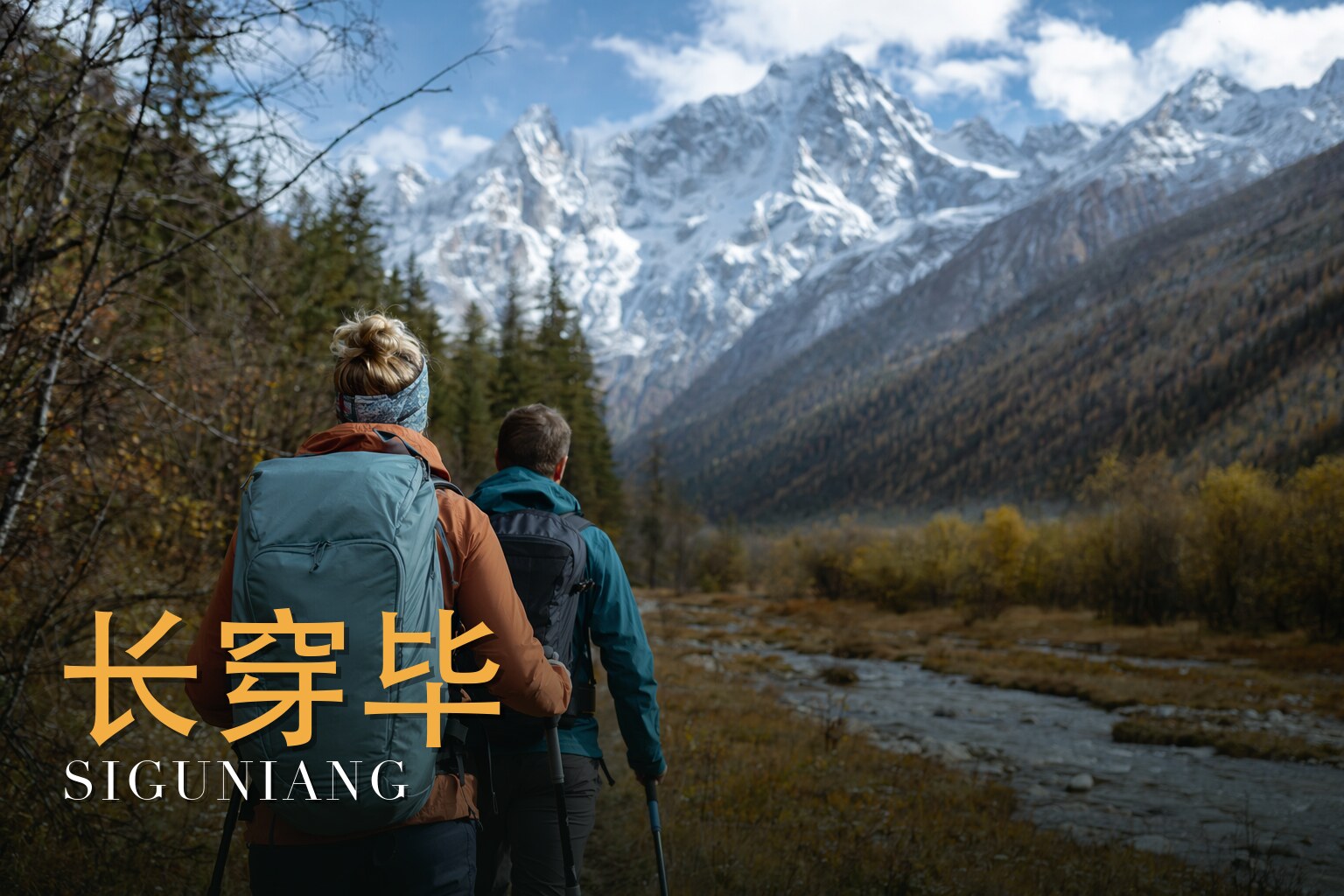
Over the Mountain of the Four Sisters: A Changping–Bipenggou Crossing
I have walked this crossing more than once, and I lead it as a licensed local guide, and I still feel the same thing every time the forest opens and Yaomei Feng — 6,250 metres, the highest of the Four Sisters and the easternmost six-thousander on Earth — stands up out of the valley like a wall set against the sky. This is a five-day journey, three of them on foot, and I will not pretend it is gentle: it is a challenging high-alpine traverse that climbs to a pass at about 4,660 metres, and the thin air, not the terrain, is the real test. Come in mid- to late October and you walk through larch and maple burning gold and red beneath fresh snow on the peaks; come in summer and the high country is cool and green. What moves me most is not the height. It is that you are walking around a sacred mountain that the people below still honour as a living god.
The land
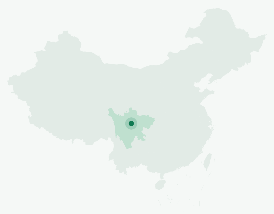
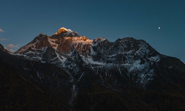
Mount Siguniang is the highest massif of the Qionglai Mountains in western Sichuan, rising on the border of Xiaojin and Wenchuan counties within the Ngawa (Aba) Tibetan and Qiang Autonomous Prefecture. Four peaks step up in height along the range — Daguniang at 5,025 m, Erguniang at 5,276 m, Sanguniang at 5,355 m, and Yaomei Feng at 6,250 m, whose topographic prominence of 2,571 m makes it the easternmost point on the planet above 6,000 metres.
The whole massif sits inside Mount Siguniang National Park, part of a UNESCO World Heritage Site inscribed in 2006 as the "Sichuan Giant Panda Sanctuaries — Wolong, Mt Siguniang & Jiajin Mountains." The park covers roughly 2,000 square kilometres and is drained by three great valleys — Changping, Haizi and Shuangqiao. Our route threads two of these worlds together: the long, forested glacial trench of Changping Valley below Yaomei's west face, and, over the pass, the larch forests of Bipenggou near Lixian. The drive in alone climbs from steamy Chengdu over the Balang Shan pass at about 4,523 m before dropping to Siguniang Town (Rilong) at roughly 3,150 m.
A short history
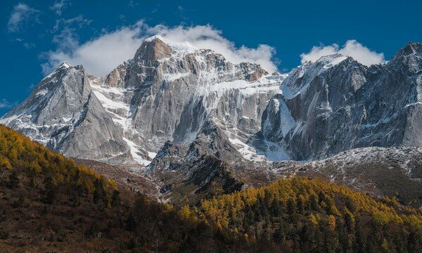
This is not a peak-bagging trek — we summit none of the four peaks, and the history of those summits belongs to a small handful of climbers. Yaomei Feng was first climbed in 1981 by a Japanese team from Doshisha University via the east ridge; the southwest ridge waited until 2008, first ascended by Chad Kellogg and Dylan Johnson. We walk beneath all of it.
The drive in carries its own recent and heavier history. The road runs up through Yingxiu, the epicentral town of the catastrophic Wenchuan earthquake of May 2008 — a magnitude 7.9 to 8.0 event whose epicentre lay roughly 20 to 30 kilometres from Wolong, killing tens of thousands. From there we enter Wolong itself, China's flagship giant-panda reserve, home to the China Conservation and Research Center for the Giant Panda, founded in 1980. The quake hit Wolong hard: the Hetaoping base was destroyed and later rebuilt as the Shenshuping (Gengda) centre with support from Hong Kong. You pass through a landscape that has been remade in living memory.
The people & their mountains
Approach this place with respect. Even the name "Four Sisters" is a Chinese softening of an older Gyalrong Tibetan title, *Skubla* — "mountain of the tutelary deity." To the Jiarong (Gyalrong) Tibetan villagers who live in the stone fortress-houses below, these are not four girls but living mountain gods. Each village along the upper Min River keeps its own mountain deity; here, the community walks an annual kora — a ritual circumambulation — around the massif, honouring it on the fourth day of the fifth lunar month for a good harvest.
A local legend tells it this way: four sisters turned themselves into these peaks to crush a man-eating demon that had devoured their father. The three elder sisters imprisoned the devil; the youngest sat upon its chest and flung her father's lost magic mirror into the sky, stopping the rains the demon had loosed — and those rains froze into the snows that crown the summits to this day. It is folklore, not history, but it is alive. You will read the living culture in the path itself: Mani stones carved with prayers, lines of prayer flags, the blockhouse stone houses, and, in the villages, Guozhuang and Xianzi dances. Walk softly here. Do not climb on the Mani cairns; let the prayer flags be.
Walking the route
The trek proper is three days on foot, roughly 35 kilometres of walking, but the journey is five days and four nights because the mountains demand patience — time to drive in, time to let your body meet the altitude. What I love about this traverse is its shape: you climb slowly up one valley with the great west wall always at your shoulder, cross a single high threshold of prayer flags, and descend into an entirely different forest on the far side. Two worlds, one pass.
Day 1 — Arrival and gathering in Chengdu
We meet in Chengdu (成都). It is a soft, humid lowland city, and the only work today is to gather, check kit, and rest before the mountains.
Day 2 — Chengdu – Yingxiu – Wolong – Siguniang Town (3,150 m)
A long drive up out of the basin, through Yingxiu and the panda country of Wolong, over the Balang Shan pass and down to Siguniang Town at about 3,150 m. We sleep here deliberately, to begin acclimatizing before we ever shoulder a pack.
Day 3 — Siguniang Town – Lama Temple (3,400 m) – Kushu Tan – Muluozi Campsite (3,760 m)
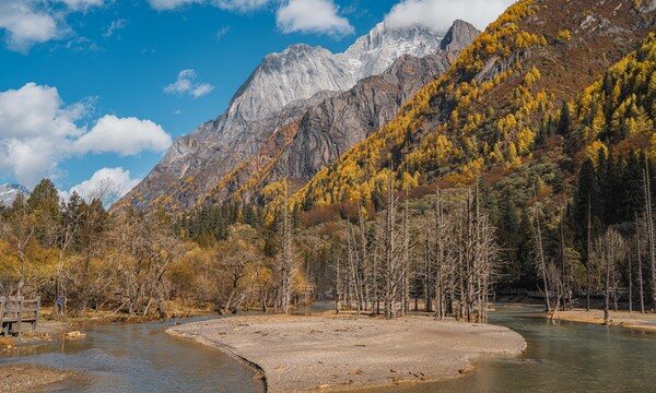
We enter Changping Valley past the Gelug-sect Tibetan Lama Temple at about 3,400 m, then walk in earnest — through the bleached "dead-tree flats" of Kushu Tan and old forests of fir, spruce, cypress and birch — to camp at Muluozi, around 3,760 m, directly beneath Yaomei's sheer, almost-vertical west wall. Mani stones and prayer flags mark the way.
Day 4 — Muluozi – Shuida Ba – Turtle Rock (Wugui Shi) – Chazigou head camp (3,900 m)
A steadier day deeper into the high country, past Shuida Ba and the landmark of Turtle Rock, to the head camp in Chazigou at about 3,900 m. We sleep high so the pass is within reach at first light.
Day 5 — Chazigou camp – Pass (4,660 m) – Shanghaizi station – Lixian – Chengdu
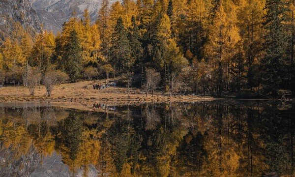
The crux. A steep climb to the prayer-flag pass at about 4,660 m — the highest point of the whole journey — and then a long, knee-testing descent into Bipenggou, where in mid- to late October the larch and maple blaze gold and red beneath fresh snow. From the Shanghaizi station we drive out via Lixian (理县) back to Chengdu. A hot-spring soak near Lixian is the traditional reward, and an earned one.
Know before you go
- When to come: The walking window runs roughly May to October; outside it, the pass is buried in snow. My favourite time is mid- to late October, when the autumn larches blaze beneath the first snow on the peaks. Summer brings cool, green, lush high country if you would rather trade the colour for milder, longer days.
- How hard: Challenging — 3.5 out of 5. The adversary here is altitude, not technical climbing: you sleep above 3,000 m for several nights and cross a pass at about 4,660 m. Gain height slowly, arrive a day or two early to acclimatize, drink well, and watch for the signs of acute mountain sickness (headache, nausea, breathlessness, poor sleep). If you have heart, lung, or blood-pressure conditions, or are unsure how you handle altitude, consult your doctor before you commit to this trek.
- Guide or solo: This crossing cannot be done solo. The national park requires a permit and a licensed local guide and horseman, with your passport and itinerary registered at the Siguniang Outdoor Office, and high-altitude insurance for foreign trekkers. Beyond the rules, there is good reason for it: the route-finding over the pass is not obvious in cloud or snow, conditions change fast at altitude, and if something goes wrong, a local team is your rescue. I lead it because I know where the weather turns and where the trail hides.
FAQ
Do we climb any of the Four Sisters? No. This is a valley-to-valley traverse that crosses a 4,660 m pass; we never summit Daguniang, Erguniang, Sanguniang or Yaomei. The peaks are companions and, to the local people, deities — not objectives.
How fit do I need to be? Fit enough for several consecutive days of hill walking with long climbs and descents, including one big day over the pass. The difficulty is endurance at altitude rather than any technical skill — no ropes, no climbing. If you hike regularly and train on hills beforehand, you will be in good shape.
What is the highest point, and where do we sleep? The high point is the pass at about 4,660 m on the final walking day. We sleep low and rising: Siguniang Town at about 3,150 m, then camps at Muluozi (~3,760 m) and the Chazigou head camp (~3,900 m). The slow build is intentional acclimatization.
Can I really not go without a guide? Correct. The park closes this crossing to independent trekking. A permit, a licensed local guide and horseman, passport and itinerary registration at the Siguniang Outdoor Office, and high-altitude insurance are all required for foreign trekkers — and genuinely safer.
How should I behave around the sacred sites? Treat the mountain as the local Gyalrong Tibetan community does. Walk past Mani stones and cairns rather than on them, do not disturb prayer flags, ask before photographing people, and keep the campsites and trail clean. You are a guest on a sacred mountain.
What is the reward at the end? Beyond the autumn forests of Bipenggou, the traditional finish is a hot-spring soak near Lixian before the drive back to Chengdu — the classic way to ease three days of high-mountain walking out of your legs.