Mt. Gongga (Minya Konka), Sichuan · 8 days / 7 nights · Challenging (4/5) · $138/day · $1,105 total per person
Duration8 days / 7 nights
DifficultyChallenging (4/5)
Max altitude~4,920 m (Riwuqie Pass)
Best seasonAutumn (September–November) for settled weather and clear views; also spring (rhododendron) and June–August (wildflowers, rainbows)
Group sizeSmall group (staff-to-guest ratio of at least 1:6)
LanguageEnglish-speaking guide on request · or local guide + Inglite app for English support
Circle the King of Sichuan's Mountains.
Highlights
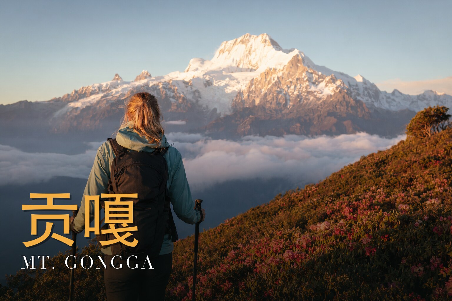
Zimei Pass — The trek's premier vantage point for a golden sunrise on Gongga's 7,556 m summit, close enough to feel cradled in the arms of the King of Sichuan's Mountains.
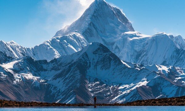
Riwuqie Valley — A hidden gem flanked by four 6,000-metre peaks (Little Gongga 6,027 m, Jiazi 6,540 m, Riwuqie 6,376 m and Reduomain 6,112 m), offering pristine, untouched high-alpine scenery.
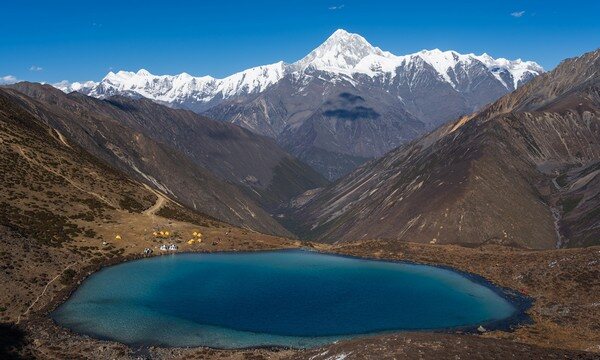
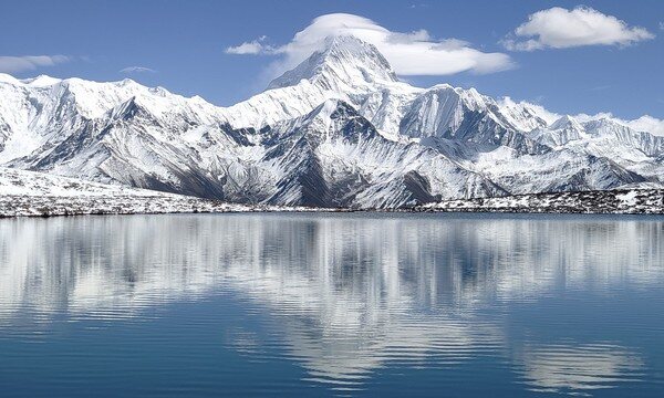
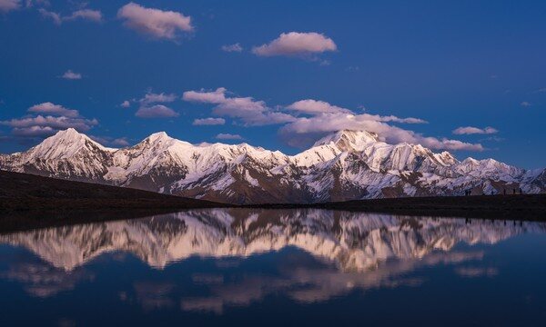
Lengga Lake (Renga / Ake Lake, 4,530 m) — An alpine mirror that reflects Gongga's summit at sunset, celebrated by photographers as the mountain's 'dressing mirror.'
Travertine Terraces — Vivid, mineral-rich calcite pools fed by springs, cascading in eight tiers over more than 900 m, their colours mirroring the sky.
Bawang (Onion) Lake — A mist-wreathed glacial lake in Gongga's hinterland, its still waters dotted with bleafless trees against lush surrounding forest.
Riwuqie Pass (4,920 m) — The highest point of the circuit, a sustained climb through shifting bands of alpine vegetation to a commanding crossing of the massif.
Yulongxi Tibetan Village — A high-mountain hamlet where prayer flags fly above sweeping views of Gongga and a dozen surrounding snow peaks.
Where in China
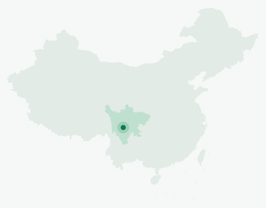
📍 Sichuan Province · Mt. Gongga (Minya Konka), western China
What you'll do
Mt. Gongga (Gòngga Shān, 7,556 m) is the easternmost 7,000-metre giant of the Hengduan Range and the undisputed "King of Sichuan's Mountains" — a jagged, snow-armoured massif ringed by more than a hundred satellite glaciers on the eastern edge of the Tibetan Plateau. This circuit traces a full loop around it, threading meadows, moraine and sacred lakes through a vertical world where ecosystems compress from subtropical valley to Arctic ice field across a single 4,000-metre rise.\n\nThe journey begins in Chengdu and climbs west over Kangding into the Gexi grasslands, where the first camp sits at 3,400 m. From there the trail pushes up the Riwuqie valley — a hidden amphitheatre walled by four peaks above 6,000 m, including Little Gongga (6,027 m), Jiazi (6,540 m) and Reduomain (6,112 m) — before the route's defining test: the crossing of the 4,920 m Riwuqie Pass, the highest point of the trek, with the alpine vegetation shifting visibly beneath your boots as you climb.\n\nBeyond the pass the walk descends into the Moxi valley and over the Yulongxi col before reaching the Tibetan village of Yulongxi, the circuit's living heart, where prayer flags snap against the summits. Side excursions reach the multi-tiered travertine terraces — vivid calcite pools the locals call the "Little Five-Colour Ponds" — and climb to Lengga Lake at 4,500 m for one of the finest sunset views of Gongga's face. The route closes over Zimei Pass, famed among photographers for its golden sunrise on the 7,556 m summit, then drops through old-growth forest and dense sea-buckthorn to Bawang Lake before the long drive out via Caoke and Ya'an back to Chengdu.\n\nFour seasons paint four different dramas here: spring snow and blooming rhododendron, summer's carpet of alpine wildflowers and post-rain rainbows, and the clarity of autumn (September to November), when fiery forests stand against silver peaks under settled skies. Gongga's beauty is famously mercurial — sudden storms, crevassed ice and thin air all demand respect — but for those who chase its "dreamlike" light, this is the Hengduan at its rawest and most magnificent.
Day by day
Day 1
Arrive in Chengdu — travellers gather from around the world
Assemble in Chengdu (Chéngdū), the gateway to the trek, and settle in for the journey ahead.
Day 2
Chengdu → Kangding (2,600 m) → Laoyulin Power Station → Gexi Grassland Campsite (3,400 m)
Drive ~310 km (about 5 hours) through Kangding to Laoyulin village, then transfer to a local minibus to the Laoyulin Power Station trailhead. From here, hike ~3 km (about 1 hour) to the Gexi grassland camp, or transfer directly by local vehicle.
Day 3
Gexi Grassland Camp (3,400 m) → Erchahe → Lower Riwuqie Camp → Upper Riwuqie Camp (4,350 m)
Hike ~15 km with 950 m of ascent (about 7 hours) up the Riwuqie valley amid sweeping plateau scenery. After roughly two hours you reach Erchahe (Two-Fork River), with vast red rock flats across the water, then continue past views of Tianhaizi (6,070 m), Little Gongga (6,027 m) and Jiazi Peak (6,549 m) to camp at Upper Riwuqie.
Day 4
Upper Riwuqie Camp → Riwuqie Pass (4,920 m) → Moxi Valley-End Camp (3,900 m)
Hike ~16 km, ascending 570 m and descending 1,020 m (about 8 hours), to cross the trek's highest point — the Riwuqie Pass — watching alpine vegetation shift on the climb, then descend through low scrub and meadow to camp at the head of the Moxi valley.
Day 5
Moxi Valley-End Camp (3,900 m) → Yulongxi Pass (4,500 m) → Yulongxi Village (3,800 m)
Hike ~15 km, ascending 600 m and descending 700 m (about 7 hours), continuing down the Moxi gully through scrub and alpine meadow and over the 4,500 m Yulongxi Pass. Grand views of Gongga and a dozen surrounding snow peaks open up before descending to the roadside and transferring by minibus to Yulongxi village for the night.
Day 6
Yulongxi Village (3,800 m) → Travertine Terraces (4,000 m) → Lengga Lake (4,500 m) → Yulongxi Village
Hike ~14 km with 500 m up and 500 m down (about 6 hours). In the early morning, walk up to the travertine terraces (the 'Little Five-Colour Ponds'), then return and transfer to the Lengga Lake trailhead. Climb with the Gongga massif towering behind you to reach Lengga Lake at 4,500 m for a magnificent sunset, then return and drive back to Yulongxi.
Day 7
Yulongxi Village → Zimei Pass (4,500 m) → Zimei Village → Bawang Lake (3,100 m) → Caoke (1,500 m)
Drive ~70 km (about 2 hours) and hike ~15 km (about 5 hours). Ride up to Zimei Pass for sunrise and fresh angles on Gongga, then descend to Lower Zimei village and hike to Bawang Lake along riverbanks through primeval forest, dense sea-buckthorn and century-old scrub. From the Bawang Lake car park, drive on to Caoke.
Day 8
Caoke → Ya'an → Chengdu
Drive ~355 km (about 7 hours) back to Chengdu, where the journey concludes.
Why this trek
The King of Sichuan's Mountains
A full circuit of Mt. Gongga (7,556 m), the easternmost 7,000-metre peak of the Hengduan Range, ringed by more than a hundred satellite glaciers.
A 4,920 m Pass Crossing
The trek's defining day tops out at the Riwuqie Pass — a sustained climb through shifting alpine vegetation to the highest point of the loop.
Sacred Mirror Lakes
Lengga Lake and the valley tarns hold flawless reflections of Gongga's pyramid summit at dawn and dusk, the photographer's 'dressing mirror.'
Sunrise from Zimei Pass
Stand close enough to feel cradled by the King of Sichuan's Mountains as first light gilds the 7,556 m face.
Included
Transport: vehicle sized to group (one seat per person), with transfers Chengdu ↔ Laoyulin, Rida Pasture ↔ Shangmuju, Muju ↔ Lengga Lake (round-trip) and Shangmuju ↔ Zimei Village
Meals: breakfasts and dinners as listed plus a celebration banquet; camp dinners (four dishes plus soup, or hot pot) and breakfasts (porridge, eggs, noodles/rice noodles), with gas, fruit and drinks
Accommodation: 1 night Chengdu hotel (standard twin), 1 night Laoyulin inn (dormitory), 2 nights camping (2 per tent), 1 night Shangmuju inn, 1 night Xinduqiao hotel
Baggage transport: personal baggage (≤20 kg) and shared supplies carried by porters/mule team (overweight charged at 50 RMB/kg)
Entry: Lengga Lake environmental fee
Professional guide service (staff-to-guest ratio of at least 1:6)
Shared equipment: camping gear (tents, awnings, kitchenware, tables/chairs), communications and emergency supplies, plus activity planning and camp setup/teardown
FAQ
How many days is the Mt. Gongga Circuit trek?
Mt. Gongga Circuit runs 8 days / 7 nights.
How hard is the Mt. Gongga Circuit trek?
It's rated Challenging (4/5), topping out around ~4,920 m (Riwuqie Pass). Reasonable hiking fitness and time to acclimatize to altitude are recommended.
What is the maximum altitude on the Mt. Gongga Circuit trek?
The high point is around ~4,920 m (Riwuqie Pass). Acclimatize gradually and take altitude-sickness precautions — consult your doctor before any high-altitude trek.
What is the best time to do the Mt. Gongga Circuit trek?
The best seasons are Autumn (September–November) for settled weather and clear views; also spring (rhododendron) and June–August (wildflowers, rainbows).
Do I need a guide for the Mt. Gongga Circuit trek, and is there English support?
English-speaking guide on request · or local guide + Inglite app for English support It's run by an independent, licensed local mountain operator, with Inglite supporting you in English the whole way.
How much does the Mt. Gongga Circuit trek cost?
Approximately $1105 per person ($138/day · $1,105 total). You arrange payment directly with the licensed local operator — Inglite never collects payment.
Who runs this
Operated by an experienced, licensed local mountain outfitter based in the Gongga region, with a professional guide team kept to a staff-to-guest ratio of at least one to six. English-language support is provided throughout via the Inglite app and your guide.
Run by an independent, licensed local operator. You arrange payment with the operator directly — Inglite connects you and never collects payment. Outdoor travel carries inherent risks; we recommend travel/outdoor insurance. Terms