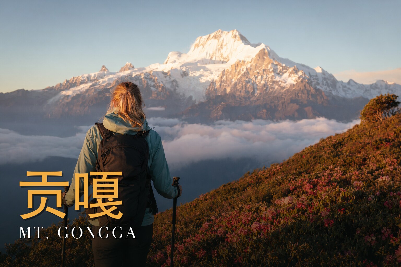
Circling the King: Eight Days Around Minya Konka
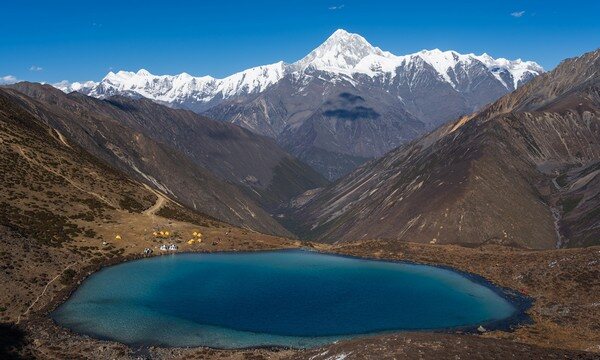
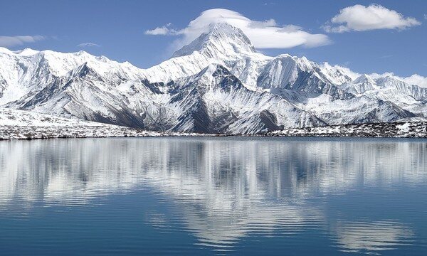
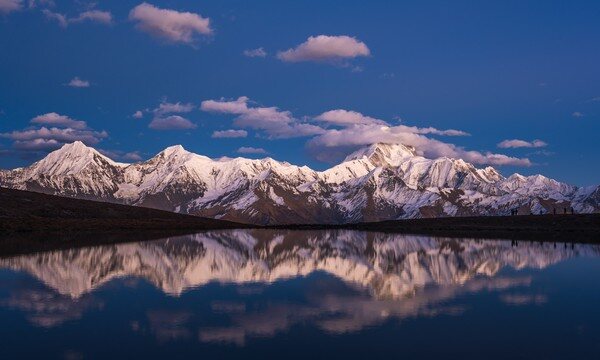
I have walked this circuit, and I lead it as a licensed local guide — so let me speak plainly about why it pulls me back. For eight days you do not climb Mt. Gongga; you walk around it, which is the honest way to meet a mountain this dangerous and this sacred. You cross a glacial pass near 4,920 m, drop into the Moxi valley, and stand one clear morning before a mirror-still lake that locals call the "Eye of Gongga," the white peak floating upside-down on the water. It is a challenging walk — real altitude, cold nights, weather that turns in an hour — and it asks for fitness and humility in equal measure. Come in autumn, September to November, when the skies settle and the King shows his full 7,556-metre face. What moves me is not conquest but proximity: walking quietly in the shadow of a giant, among prayer flags and herders' grasslands, and being let close enough to feel small.
The land
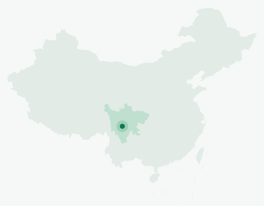
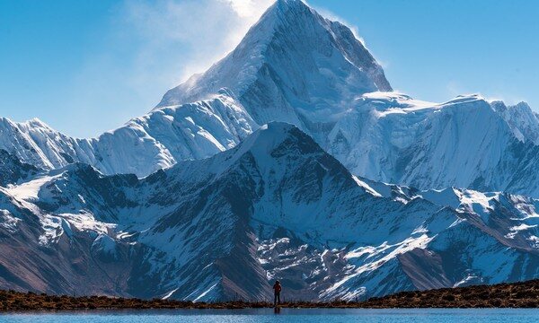
Mt. Gongga — Minya Konka to the Tibetans of this region — is the King of Sichuan's mountains: the highest peak in the province and, remarkably, the easternmost and most isolated 7,000-metre summit anywhere on Earth. Its historically standard height is 7,556 m; a 2023 national re-survey, using satellite positioning and space photogrammetry, put it at 7,509 m. By either figure it ranks around the 41st-highest mountain in the world and the third-highest outside the Himalaya and Karakoram. Its prominence is about 3,600 m.
The numbers only begin to describe it. From the summit the land plunges roughly 6,400 metres to the Dadu River, barely 29 km to the east — one of the largest local relief differences on the planet. The massif is granodiorite, with four great ridges and slopes that steepen to around 70 degrees. More than seventy glaciers spill off it; the five largest are Yanzigou, Hailuogou, Mozigou, Gongba, and Bawang. Hailuogou, about 14 km long, feeds China's largest glacial icefall — roughly 1,080 m high and 1,100 m wide — and below it, hot springs surface between about 40 and 90°C. The snow line sits near 5,500 m.
This is also a biodiversity hotspot with a near-complete sequence of altitudinal life zones, protected as a National Nature Reserve since 1997. Some 2,500 vascular plant species grow here (185 families, 869 genera), and the fauna reads like a roll-call of the Hengduan ranges: giant panda, snow leopard, Thorold's deer, musk deer, Asian golden cat, and the Chinese monal.
A short history
The mountain's modern story begins with the botanist-explorer Joseph Rock. In 1929 he cabled National Geographic that Minya Konka might be the highest mountain on Earth, estimating it at some 30,250 ft (9,220 m) — an error of enthusiasm he later corrected down to about 7,803 m. His account, "The Glories of the Minya Konka," appeared in National Geographic in October 1930, and he spent a night at Konka Gompa, the monastery on the mountain's western flank.
Two years later came the climbers. A four-man American party — the 1932 "Sikong Expedition" of Richard Burdsall, Arthur Emmons III, Terris Moore, and Jack Young — attempted the peak alpine-style, without porters. On 28 October 1932, Moore and Burdsall reached the summit by the northwest ridge. Their surveyed height came to about 7,587 ft over 24,800 — close to the long-accepted figure. It remained the highest summit achieved by Americans for the next twenty-six years. The cost was real: Emmons suffered severe frostbite and lost toes. Their story survives in the book *Men Against the Clouds*.
And there is a sobering thread worth telling honestly. Minya Konka is widely reported to have one of the highest fatality rates of any mountain in the world — a claim repeated across many sources, said even to exceed Everest and the 8,000-metre peaks. The 1957 Chinese expedition put six climbers on top, but four died on the descent. By one accounting around 2003, 22 people had summited and 16 had died; by 2017, roughly 32 summits against 21 deaths. We do not climb it. We walk around it — which, on a mountain like this, is its own kind of wisdom.
The people & their mountains
This is Kham, eastern Tibet, and to walk here is to walk through someone's sacred ground. The mountain's Tibetan name, Mi'nyag Gongga, belongs to the Mi'nyag (Minyak) people — a name that carries a faint echo of the lost Tangut kingdom of Western Xia. To them the peak is not scenery; it is a presence, a "white snow mountain" watched over and revered.
You feel this everywhere on the trail: in the mani stones carved with prayers, in the prayer flags strung across the passes and fading in the wind, in the still sacred lakes that hold the mountain's reflection. The centuries-old Konka Gompa monastery sits on the western flank, the same place Joseph Rock once sheltered. As a guide I ask the same of everyone, fit or not: tread gently. Walk clockwise where others do, leave the mani stones as you find them, do not wade into the lakes, and let the herders and their yaks have the path. We are guests of both the mountain and the people who hold it holy.
Walking the route
What I love about this circuit is how completely it transforms underfoot. You begin in grasslands among grazing horses, climb into a thin-aired world of rock and ice at the high pass, and end days later moving through primeval forest dripping with moss. It is roughly eight days of true high-alpine walking from the Kangding side, with pack horses carrying the loads — the right way to do it, and far safer than going solo. Below, the day-by-day; I give approximate altitudes, but I won't pretend to exact distances or hiking times, which shift with weather, group pace, and snow.
Day 1 — Arrive in Chengdu
We gather in Chengdu, travellers drifting in from around the world. A first dinner together, a kit check, and an early night — the real journey starts tomorrow, and so does the climb in altitude.
Day 2 — Chengdu → Kangding (2,600 m) → Laoyulin Power Station → Gexi Grassland Campsite (3,400 m)
We drive west and up onto the plateau, through Kangding and past the Laoyulin power station, then make our first camp on the open Gexi grassland at about 3,400 m. The air already feels thinner; this is where acclimatization quietly begins.
Day 3 — Gexi Grassland Camp (3,400 m) → Erchahe → Lower Riwuqie Camp → Upper Riwuqie Camp (4,350 m)
A steady climb through Erchahe and past the lower Riwuqie camp brings us to the upper camp at around 4,350 m. We pitch high tonight, deliberately, to be poised below the pass — and to let our bodies adjust before the big day.
Day 4 — Upper Riwuqie Camp → Riwuqie Pass (4,920 m) → Moxi Valley-End Camp (3,900 m)
The hardest and finest day. We cross the Riwuqie Pass near 4,920 m — the high point of the whole circuit — where the glaciers feel close enough to touch. Heavy snow can close this pass, so we watch the weather and move early, then descend into the head of the Moxi valley to camp around 3,900 m.
Day 5 — Moxi Valley-End Camp (3,900 m) → Yulongxi Pass (4,500 m) → Yulongxi Village (3,800 m)
Up over the Yulongxi Pass at about 4,500 m, then down into Yulongxi village at roughly 3,800 m. After nights in tents, the village feels almost like arriving somewhere — a settled rhythm of homes, smoke, and prayer flags.
Day 6 — Yulongxi Village (3,800 m) → Travertine Terraces (4,000 m) → Lengga Lake (4,500 m) → Yulongxi Village
A lighter loop day to the travertine terraces near 4,000 m — pale stone basins of mineral water — and up to Lengga Lake at about 4,500 m. This is the country of the sacred lakes, where on a still, clear morning the peak lies mirrored on the water. We return to Yulongxi for the night.
Day 7 — Yulongxi Village → Zimei Pass (4,500 m) → Zimei Village → Bawang Lake (3,100 m) → Caoke (1,500 m)
A long descent day. Over the Zimei Pass near 4,500 m, down through Zimei village and past Bawang Lake at around 3,100 m, the landscape softens into forest. We drop a long way — to Caoke at about 1,500 m — and you can feel the air thicken and warm with every hour.
Day 8 — Caoke → Ya'an → Chengdu
We drive out through Ya'an and back to Chengdu, the mountain behind us now. There is always a quietness on this last leg — the body tired, the mind still up at the pass.
Know before you go
- When to come: Autumn (September–November) is best, for settled weather and the clearest views of the peak. Spring brings blooming rhododendron, and June through August offers wildflowers and frequent rainbows — but also more cloud and rain. Whenever you come, expect cold nights and weather that changes fast.
- How hard: This is a challenging trek (4 out of 5), with a high point near 4,920 m at the Riwuqie Pass and many days spent above 4,000 m. Altitude is the real difficulty — everyone, fit or not, must respect the thin air. We build in acclimatization, ascend gradually, and never rush the high days. If you have any heart, lung, or blood-pressure condition, or any concern about high altitude, consult your doctor before committing.
- Guide or solo: Go guided, with pack horses, not solo — I say this as someone whose job it is to bring people back. The route crosses remote passes with no signposts and patchy or no phone signal; navigation is genuine, snow can close the top pass, and rescue from above 4,000 m is slow and serious. A licensed local guide handles the route, the horses, permits, the language across Tibetan and Mandarin, and the call on when weather makes a pass unsafe.
FAQ
How high do we actually go, and is the pass figure exact? The circuit's high point is the Riwuqie Pass, which we treat as about 4,920 m. Be aware that different operators and route variants put the top pass anywhere from roughly 4,850 to 4,980 m, so think of 4,920 m as sitting within that credible band rather than as a fixed survey number. Several days run above 4,000 m.
Do we climb Mt. Gongga itself? No — and that's the point. We walk a complete circuit around the mountain. Minya Konka is one of the deadliest peaks in the world; very few climb it, and we are here to circle it respectfully, not to summit.
Where do we sleep? Mostly in tents at high camps — Gexi grassland, the Riwuqie camps, the Moxi valley — with nights in Yulongxi village partway through. Bring a sleeping system rated for genuine cold; nights above 3,400 m get hard.
What's the terrain like underfoot? Everything in eight days: open grassland, rocky high passes with possible snow, travertine and lakeshore, and a long forested descent toward Caoke. Sturdy broken-in boots and trekking poles earn their keep, especially on the big drop on Day 7.
Will I have phone signal or a way to charge devices? Assume long stretches with no signal across the high passes and camps, and no reliable power until lower villages or the end. Carry a power bank, download offline maps, and let people at home know you'll be off-grid.
How should I prepare physically and culturally? Arrive genuinely fit for multi-day walking with weight, and ideally with some prior altitude experience. Just as important: come ready to move gently through sacred ground — leaving mani stones and prayer flags undisturbed, keeping out of the holy lakes, and giving way to herders and their animals on the trail.