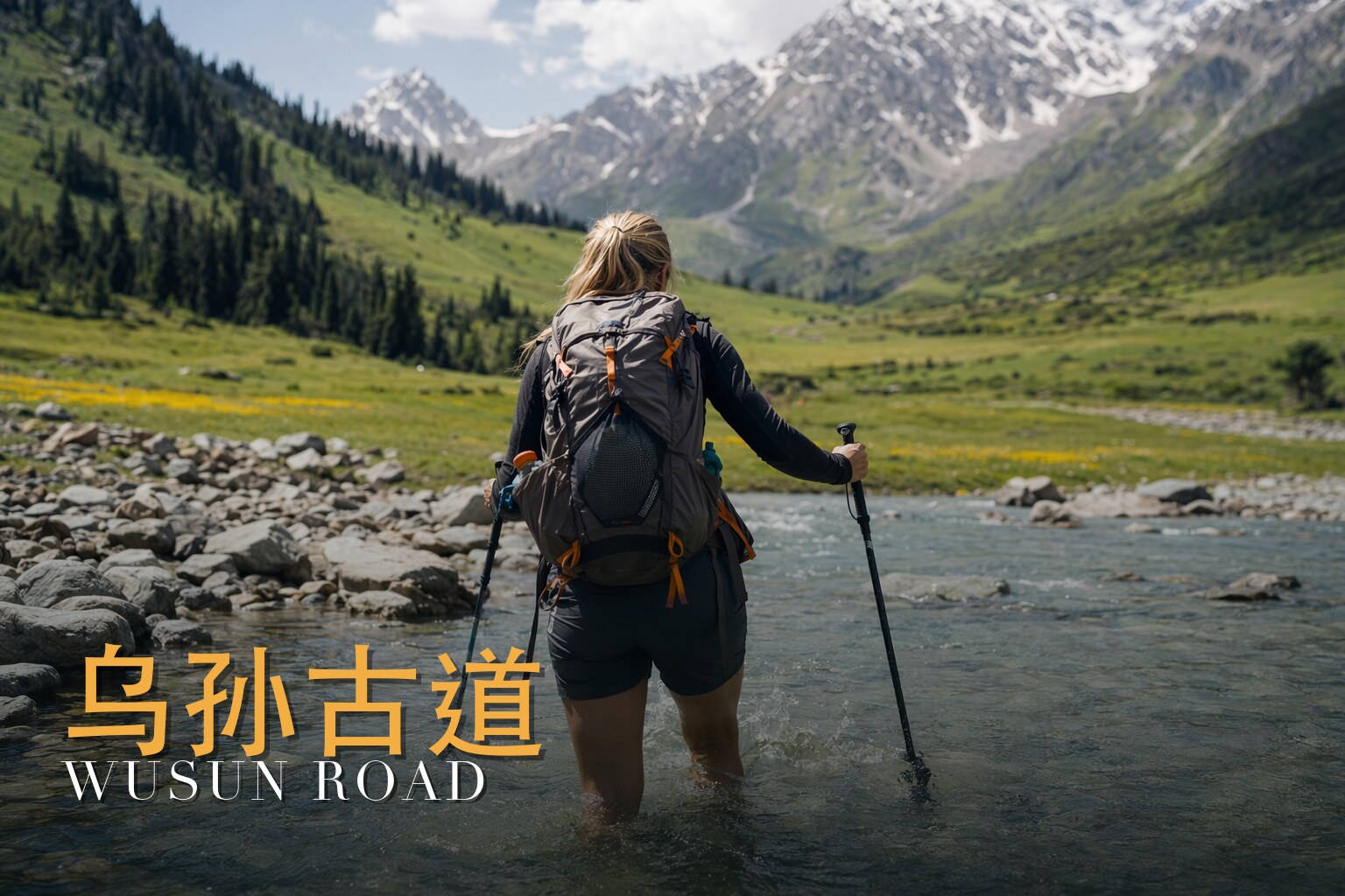
The Road Over the Spine of the Tianshan
I have walked this road, and I lead it. Nine days, eight nights, six of them under canvas with pack horses and no resupply — a long, demanding traverse I'd rate four out of five, not for its single hard hour but for how many hard hours it strings together. What moves me about the Wusun Ancient Road isn't the difficulty, though. It's the lineage. You climb out of a Kazakh log-house village, over two glaciated passes, past a turquoise lake nobody back home has heard of, and you are following a line people have walked for two thousand years — a shortcut over the mountains between the grasslands of the north and the oasis kingdoms of the south. Come in high summer, July to early September, when the high passes are most reliably open. That's the only window I trust, and even then I read the sky every morning.
The land
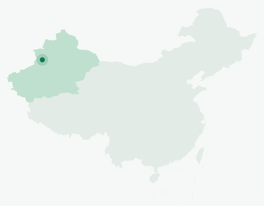
This is a north–south crossing of the Tianshan, the great range that walls off the Ili Valley from the Tarim Basin. We start low and green in the north, in Kazakh pasture country near the Kalajun grasslands, and we finish far to the south near Kuqa, on the dry rim of the oasis world. In between, the trail does in a few days what most landscapes take a continent to do.
You begin in dark forests of Schrenk's spruce, climb into rolling alpine meadow, and end up on bare, glaciated ground where the only colors are rock, snow and ice. Locals call it "four seasons in one mountain," and they are not exaggerating — I have started a morning in shirtsleeves among wildflowers and finished it kicking steps up a frozen slope. Two passes define the route: the Qiong Pass at roughly 3,700–3,740 m, and the trek's high point, the Akebulake Pass, at around 3,800–3,830 m. Between and below them run glacier-fed rivers — the Koksu in the north, the meltwater braids of the Bozikerige valley in the south — cold, fast, and the source of most of the route's genuine hazard. Treat every distance and altitude I give as approximate; published sources put the route anywhere from about 90 to 135 km and disagree on pass heights by 50 to 100 metres.
A short history
The Wusun were a semi-nomadic steppe people. They first appear in the record living between the Qilian Mountains and Dunhuang, in what is now Gansu, before being pushed west. Around the 130s BC — the chronicles say roughly 133–132 BC — the Wusun under their leader Liejiaomi took the Ili Valley from the Yuezhi, the same Yuezhi who, a generation earlier (about 173 BC), had killed the Wusun king Nandoumi. From the Ili Valley to the shores of Issyk-Kul, the Wusun became one of the strongest of the so-called Western Regions states, with their capital at Chigu, the "Red Valley City," in a side valley toward that lake.
When the Han court sought an ally against the Xiongnu, it sent the envoy Zhang Qian toward the Wusun around 125 BC; he returned as ambassador about a decade later, near 115 BC. The envoy's own report estimated the Wusun at some 630,000 people, with around 188,000 men who could bear arms. The alliance was sealed by marriage. Princess Liu Xijun was sent to live among them, and later Princess Jieyou, who remained in the Western Regions for roughly fifty years before returning to Chang'an around 51 BC. Their rulers held the title Kunmi. As for the road itself: it was a real trans-Tianshan branch of the Silk Road, linking the Wusun grasslands of the Ili Valley with the oasis kingdom of Qiuci — Kucha — to the south. The "two-thousand-year-old road" framing you'll hear is popular shorthand rather than a surveyed measurement; treat the single-year dates loosely, too, because the old chronicles wobble by a few years between sources.
The people & their mountains
The valley is still alive with nomadic culture. We begin in Qiongkushtai, a Kazakh village of weathered timber log houses that China named a National Historic and Cultural Village in 2010 — and, more importantly to anyone passing through, still a working transhumance way-station, where herding families move between summer yurts up high and winter cabins below. Along the trail you'll meet shepherds on horseback, hear dogs before you see a camp, and likely be waved toward a bowl of something warm.
I ask my groups to meet these families as the living horse-and-pasture culture of the Tianshan that they are — heirs to a steppe world of felt tents, fermented mare's milk and grazing herds. What I won't do, and what I'd ask you not to do either, is tell them they are the literal descendants of the ancient Wusun. That's a romantic story more than a settled one, and the people here deserve to be seen for who they actually are rather than as a costume for someone else's history. Accept hospitality graciously, ask before photographing, and remember you are a guest moving through someone's summer home.
Walking the route
What the route feels like, day to day, is a slow tightening. The first days are forgiving and beautiful, all forest and meadow and river. Then the mountains close in, the passes arrive, and the southern descent makes you earn every metre back with cold water around your knees. Below are the days as we walk them — altitudes approximate, and I won't pretend to give you exact kilometres or hours, because conditions move them every season.
Day 1 — Assemble in Yining (伊宁)
We gather in Yining, sort gear, brief the route and the river crossings, and sleep one last night with a roof and a hot shower.
Day 2 — Yining — Tekes — Qiongkushtai trailhead — Qiongkushtai River Valley Camp
A long road day through Tekes to the trailhead at Qiongkushtai, then an easing walk up the river valley to our first camp among the spruce — the lungs and legs find their rhythm.
Day 3 — Qiongkushtai River Valley Camp — Qiong Pass (琼达坂, 3,740 m) — Kunuosayi Camp (3,300 m)
The first real test: up out of the forest to the Qiong Pass at around 3,740 m, then down to Kunuosayi at about 3,300 m. The altitude announces itself today.
Day 4 — Kunuosayi Camp — Kekesu River Camp (阔克苏河营地, 2,000 m)
A long descent to the glacier-fed Koksu River at roughly 2,000 m, a valley historically crossed by zipline. We camp by water that runs grey with rock flour.
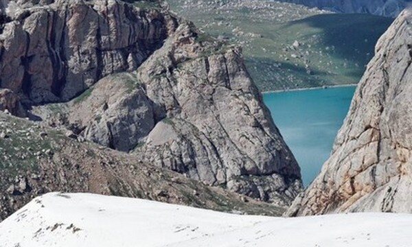
Day 5 — Kekesu River Camp — Heavenly Lake (天湖/天池, 3,050 m)
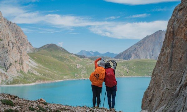
A steady climb back up to Heavenly Lake — a turquoise alpine tarn at about 3,050 m, ringed by snow and ice. (Don't confuse it with the famous White Lake near Kanas, which shares a Kazakh name but sits far lower.)
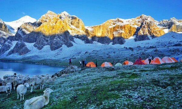
Day 6 — Heavenly Lake — free day
A rest and acclimatization day at the lake. Wash, dry gear, photograph the peaks at first light, and let your body bank some altitude before the crux.
Day 7 — Heavenly Lake — Tiger's Mouth (老虎口) — Akebulake Pass (阿克布拉克达坂, 3,830 m) — Upper Bozikerige Valley Camp (3,000 m)
The big day. Through the narrows called Tiger's Mouth and up the snow-and-scree wall of the Akebulake Pass, the high point at around 3,830 m, then a long drop to camp at about 3,000 m. The pass thaws by day and refreezes at night, so we time our crossing to the weather, not the clock.
Day 8 — Upper Bozikerige Valley Camp (3,000 m) — Lower Bozikerige Valley Camp (2,180 m)
Down the Bozikerige valley to about 2,180 m — and into the fordings. This is the day of cold-river crossings, one after another, water only a few degrees above freezing.
Day 9 — Lower Bozikerige Valley Camp — Heiyingshan Pass (黑英山山口, 1,940 m) — Kuqa (库车)
A final descent through the Heiyingshan Pass at around 1,940 m and out to the road, where vehicles carry us into Kuqa — the green mountains behind us, the dry south ahead.
Know before you go
- When to come: High summer only — July to early September. That's when the Qiong and Akebulake passes are most reliably free of impassable snow and the rivers, while still cold, are crossable. Outside that window the high ground is a different and far more serious proposition, and the route has at times been officially closed to unpermitted trekkers.
- How hard: Challenging — four out of five. The difficulty is cumulative: back-to-back long days, six nights of camping, no resupply, and a high point near 3,830 m. Altitude is a real factor above 3,000 m, which is why we build in a free day at Heavenly Lake to acclimatize. Ascend steadily, hydrate hard, and tell me at once if you feel headache, nausea or breathlessness that won't settle. If you have heart, lung, or blood-pressure conditions, or any doubt about high altitude, consult your doctor before committing to this trek.
- Guide or solo: Go guided — I say this plainly, not as a sales line. The route is genuine wilderness with no resupply; navigation across the passes is non-trivial in cloud or fresh snow; the Bozikerige fordings carry real hypothermia and flash-flood risk after rain; and rescue is slow and far away. A licensed local operator with pack horses, river-crossing judgment and an English-speaking link for foreign clients turns a high-consequence route into a manageable one. The permit situation alone is reason enough not to attempt it alone.
FAQ
How fit do I need to be? Fit enough to walk six to eight hours a day on rough ground, day after day, carrying a daypack while horses take the heavy load. If you train on hills with real elevation gain and can string consecutive long days together, you'll cope. The passes and the cumulative fatigue are what catch people, not raw speed.
How cold does it get, and what about the river crossings? Nights at the high camps can drop below freezing even in July, so a proper four-season-ish sleep system matters. The crossings are the bigger concern: glacier-melt water only a few degrees above freezing, dozens of fordings on the southern descent, and a real chance of flash flooding after rain. We cross at the safest points and times, and we wait when we have to. Bring footwear you can ford in.
Will I have phone signal or any resupply? Assume none. This is unsupported wilderness for the camping days — what we carry is what we have. That's exactly why we run it with pack horses and a margin of food and contingency days.
Is this the same Heavenly Lake / White Lake near Kanas? No. Our turquoise tarn sits high in the Tianshan at around 3,050 m, ringed by ice. The famous White Lake near Kanas shares a Kazakh name but lies far to the north and much lower. Different lake, different mountains.
Do I need a permit, and can I just do it independently? The corridor has, at times, been closed to trekkers without permits, and conditions change year to year. Going with a licensed local operator is the practical way the permitting, the river judgment and the rescue cover are handled — which is the honest reason solo attempts are a bad idea here.
Are the Kazakh families I'll meet descended from the ancient Wusun? They're the living nomadic culture of this valley — heirs to the steppe horse world in spirit and livelihood. But a direct bloodline to the ancient Wusun is folklore rather than settled history, and I'd encourage you to meet them as the Kazakh herders they are, not as a museum exhibit.