Beneath the God Who Will Not Be Climbed: Six Days to Yubeng
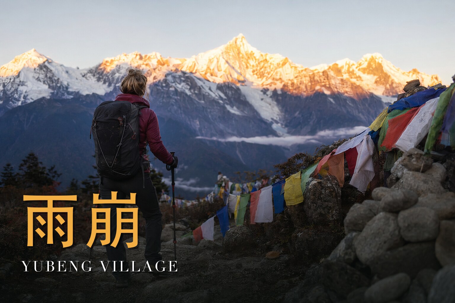
I have walked this trail in the thin gold light of dawn and in the wet green hush of the forest, and I still cannot get used to it. We are going to the foot of Kawa Karpo — at 6,740 metres the highest mountain in Yunnan, and one of the most sacred peaks in the whole Tibetan world. We are not going to climb it; no one is allowed to, and most people here would tell you no one ever should. We are going to walk beneath it, the way pilgrims have for centuries, over six days and five nights of moderate but real mountain walking. It is the altitude, not the gradient, that asks for your respect — our high point is the Ice Lake at about 3,800 metres. Come in late spring (May–June) or autumn (September–October), when the air is clearest and the peak is most likely to show itself. It hides far more often than it shows. That, too, is part of the pilgrimage.

The land
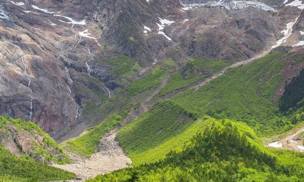
These are the Hengduan Mountains, crumpled into being when the Indian plate drove north into Asia — young mountains, steep and still rising. Just east of our route, three of the great rivers of Asia run side by side: the Yangtze (here called the Jinsha), the Mekong (the Lancang) and the Salween (the Nujiang). They flow in parallel through gorges so deep and so close together that the ridges dividing them narrow to only a few kilometres. This is the UNESCO Three Parallel Rivers of Yunnan World Heritage Site, inscribed in 2003 — a serial property of roughly 1.7 million hectares and one of the richest temperate ecosystems on Earth, a country of rhododendrons and primulas.
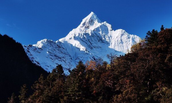
Kawa Karpo anchors the Meili Snow Mountains, a range carrying thirteen summits above 6,000 metres — the "Prince's Thirteen Peaks" — strung along the Yunnan–Tibet border between the Salween to the west and the Mekong to the east. Beside Kawa Karpo stands Mianzimu (about 6,054 metres), the "Sea Goddess," held to be the mountain's consort. And down the eastern flank pours the Mingyong Glacier, descending to around 2,700 metres at roughly 28.5°N — China's lowest-latitude glacier, monsoon-fed and slowly retreating.
A short history
For all its sanctity, this mountain carries a heavy modern story. Kawa Karpo has never been climbed. In the winter of 1990–91 a joint Chinese–Japanese expedition tried; on the night of 3 January 1991 an avalanche killed all seventeen of them — among the worst disasters in the history of mountaineering. Years later, from 1998 onward, the glacier gave the bodies back: human remains emerged on the Mingyong Glacier, carried down inside the moving ice. One climber, the doctor Hisanobu Shimizu, was never found. In 2001 the local government banned all climbing outright, on cultural and religious grounds. To this day Kawa Karpo remains one of the world's most prominent never-summited peaks.
A century before that, this corner of Yunnan drew Western plant-hunters and explorers — among them Joseph Rock, whose *National Geographic* dispatches from these mountains are often said to have helped seed James Hilton's idea of "Shangri-La."
The people & their mountains
To the Tibetans who live in its shadow, Kawa Karpo is not a peak to be conquered but a deity to be honoured — the spiritual home of a warrior protector god of the same name. To stand on the summit is held to be sacrilege, an act that would drive the god from his seat. That belief is not abstract scenery here; it is why the mountain is closed, and it shapes how we move through this landscape.
The mountain is the goal of a great pilgrimage. Devotees walk a clockwise kora — the outer circuit runs roughly 240 kilometres — and some twenty thousand pilgrims make it each year. The merit is believed to be greatest in the Tibetan Year of the Sheep (or Goat), the deity's own zodiac year, when the trails fill far beyond their usual numbers. We walk as guests inside this living tradition: clockwise, slowly, with a local guide, on local terms.
Walking the route
The shape of these six days is simple and right: we drive north into ever bigger country, we stand at dawn before the peak, and then the road ends and we walk — because there is no road into Yubeng, only the trail. What follows is hard-won and quiet rather than dramatic, and the village itself, hidden at around 3,100–3,200 metres and split into an upper and lower settlement, feels like a reward you arrive at on foot or not at all.
Day 1 — Arrival in Lijiang
We gather in Lijiang, at the gentler end of the journey. Rest, eat, hydrate; the altitude work begins tomorrow, and the body does better when it starts unhurried.
Day 2 — Lijiang → Xiaozhongdian → Moon Bend → Feilai Temple
A long drive north traces the Jinsha — the upper Yangtze — past its great moon-shaped bend, then climbs into high country toward Deqin, finishing at Feilai Temple facing the range.
Day 3 — Feilai Temple → Golden Summit at sunrise → Ninong Valley → Yubeng Village
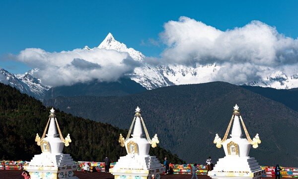
At dawn we stand among the white stupas of Feilai Temple, and — if the weather grants it — the summit ignites gold for just a few minutes, the "sun-gilt golden mountain." Then the road ends: we drop into the Ninong canyon along the Mekong and walk on foot up to Yubeng, at around 3,100–3,200 metres.
Day 4 — Yubeng Village → primeval forest → Sacred Waterfall → return
A day up through old-growth forest to the Sacred Waterfall, where pilgrims pass beneath the icy meltwater to be purified. A gentler day, and a beautiful one, before tomorrow's climb.
Day 5 — Yubeng Village → sea-buckthorn thickets → Xiangnazong Pass → Xiaonong Base Camp → Ice Lake → return
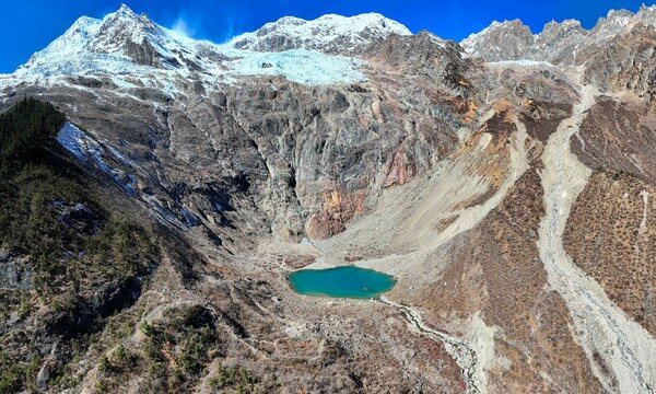
The hardest day. We climb through sea-buckthorn thickets, over the Xiangnazong Pass and past Xiaonong Base Camp to the Ice Lake at about 3,800 metres, cradled right at the glacier's lip. We go slowly and drink often; the altitude is what asks for respect here, not the steepness.
Day 6 — Yubeng Village → Ninong Canyon → Deqin → Shangri-La → Lijiang
We walk back out through the Ninong Canyon and rejoin the road, the long drive carrying us through Deqin and Shangri-La and back to Lijiang — the mountains slowly releasing us.
Know before you go
- When to come: Late spring through autumn is the window. May–June and September–October offer the clearest air and the best odds of the peak showing itself — though Kawa Karpo hides in cloud as often as it shows, so treat a clear summit as a gift rather than a guarantee.
- How hard: Moderate (3/5). The walking is real but the true challenge is altitude: the village sits near 3,100–3,200 metres and the Ice Lake reaches about 3,800 metres. Acclimatize, ascend slowly, drink plenty, and know the signs of altitude sickness. If you have heart, lung, or other relevant medical conditions, consult your doctor before committing to a high-altitude trek.
- Guide or solo: Go with a guide, honestly. There is no road into Yubeng and the terrain — canyon, forest, high pass — rewards local knowledge for navigation, weather, and, if it ever comes to it, rescue. A local lead guide also means you move through a sacred landscape with someone who understands its customs. Inglite supports foreign clients in English alongside the licensed local operator.
FAQ
How fit do I need to be? Comfortably fit rather than athletic. If you can walk uphill for several hours over consecutive days, you can do this trek. The summit day to the Ice Lake is the test — pace yourself and it is very manageable.
Will I actually see the mountain? Maybe. Kawa Karpo is famously shy and spends much of its time in cloud. Dawn at Feilai Temple and clear days from Yubeng give you your best chances, especially in late spring and autumn, but no honest guide will promise you the summit.
How do I handle the altitude? Arrive rested, ascend gradually, drink more water than feels necessary, and tell your guide immediately if you feel headache, nausea, or breathlessness beyond normal exertion. Day 1 in Lijiang and the staged climb are built to help you adjust.
Is there really no road to Yubeng? Correct. The only way in is on foot, down into the Ninong canyon and up the trail. That is precisely why the village still feels hidden.
What should I know about the local customs? You are walking through a living pilgrimage landscape. Walk clockwise where pilgrims do, treat stupas, prayer flags, and the Sacred Waterfall with respect, and follow your guide's lead. The mountain was holy long before it was a trek.
What will the days feel like? A rhythm of driving, then walking, then walking more deeply in. Expect long views and long quiet, forest and high pass, cold meltwater and thin bright air — and a village you can only reach the slow way.