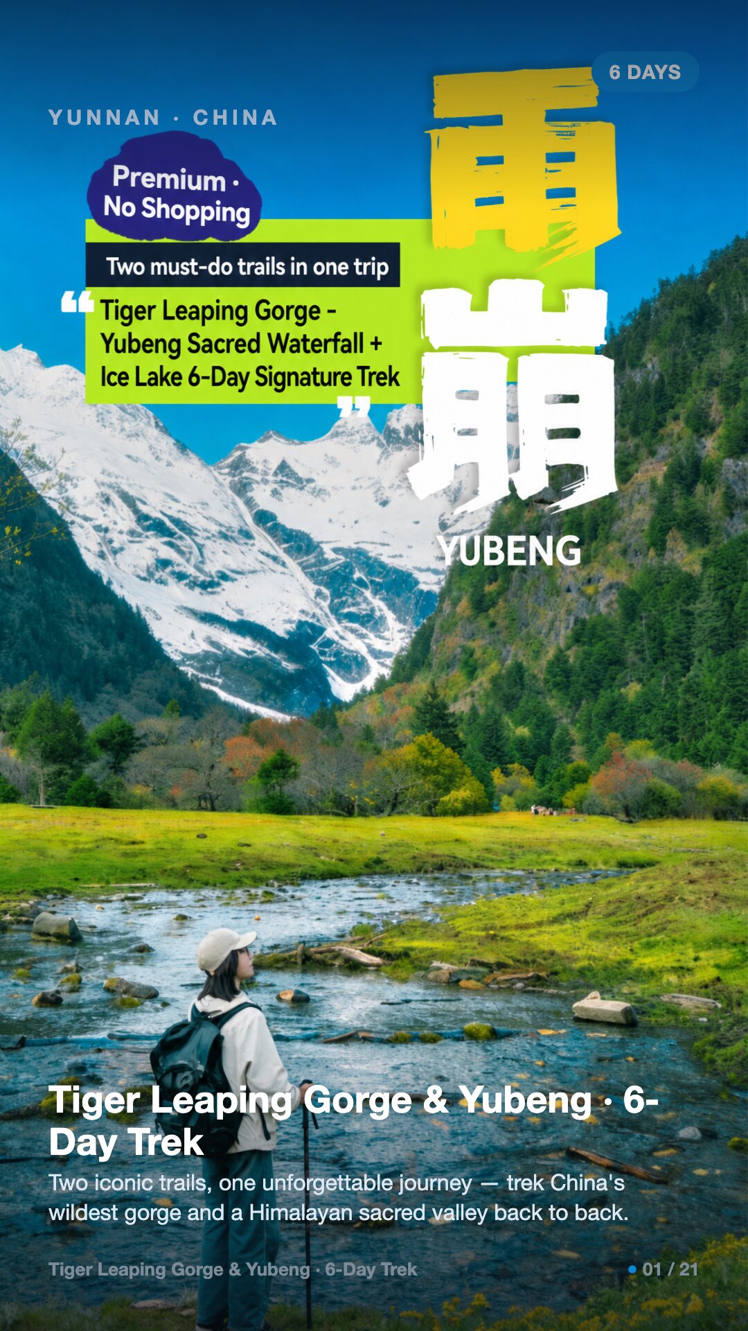

Tiger Leaping Gorge & Meili / Yubeng, Yunnan · 6 days / 5 nights · Moderate (3/5) · max ~3,900 m · $87/day · $520 total per person
Two iconic trails, one unforgettable journey — trek China's wildest gorge and a Himalayan sacred valley back to back.
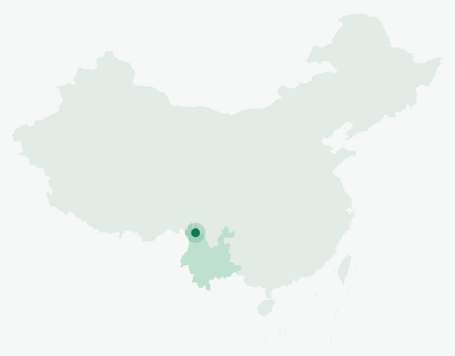
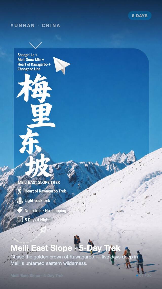
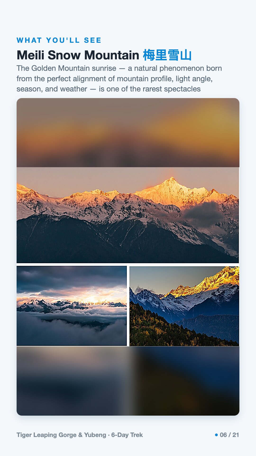
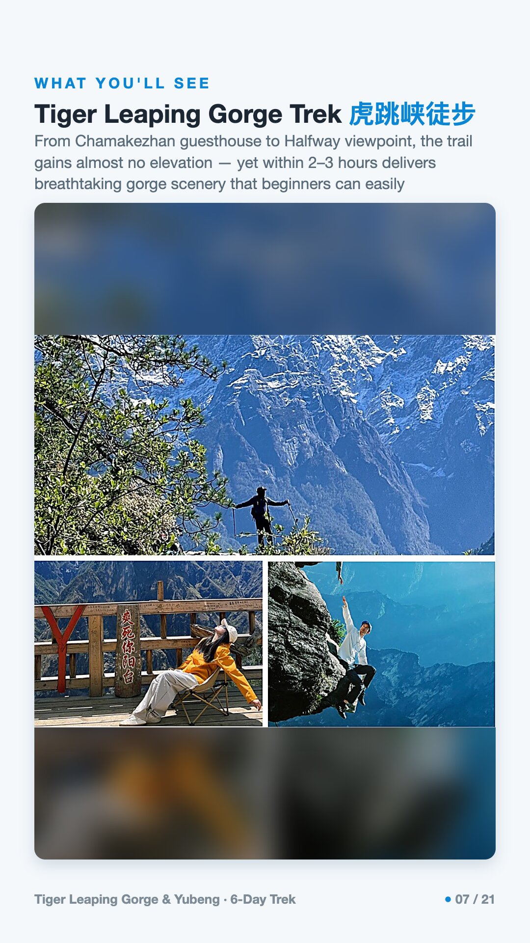
Yubeng is a pair of Tibetan hamlets — Lower and Upper — in a valley under Meili Snow Mountain, in Diqing in Yunnan, southwest China. Kawagarbo, highest of Meili's thirteen summits, is sacred, and the Sacred Waterfall below its cliffs is a place of purification that pilgrims travel for days to bathe in. Five of the six days are on foot, roughly 66 km in all. The high point is about 3,900 m, at the Shangna-La-Yi Pass and at Ice Lake — glacier-fed, deep jade green, ice reaching the shoreline — on the longest day, some 18 km and six to seven hours. The rest run roughly 10 to 14 km at 2,000–3,600 m, and the passages through Ninong Gorge want care. Tiger Leaping Gorge is the gentlest walking: the high road to the Halfway viewpoint gains almost no height while the gorge opens below, and beginners manage it comfortably. You carry a 20–30 L daypack; a wheeled case stays in the vehicle, as wheeled bags cannot enter Yubeng village. One night is at Feilai Temple, around 3,300 m in an oxygen-supplemented hotel, and three in Yubeng guesthouses — hot water, clean bathrooms, snow mountains in the window, simple rather than smart. A licensed mountain leader and a driver stay with the group of two to eight throughout. The grade is moderate, three out of five; the seasons are March to June and September to November. Ages run 10 to 65 and good health is needed: not suitable with hypertension, heart, respiratory or infectious disease, serious anaemia, impaired mobility or pregnancy. The Golden Mountain sunrise over Meili is twenty minutes of light, and entirely weather-dependent.
Honestly one of the easiest trips I've done as a foreign traveler — everything was sorted for us start to finish… the trekking scenery in China is genuinely world-class.
— Tim J.
Tiger Leaping Gorge & Yubeng runs 6 days / 5 nights.
It's rated Moderate (3/5), topping out around ~3,900 m. Reasonable hiking fitness and time to acclimatize to altitude are recommended.
The high point is around ~3,900 m. Acclimatize gradually and take altitude-sickness precautions — consult your doctor before any high-altitude trek.
The best seasons are Mar–Jun · Sep–Nov.
English-speaking guide on request · or local guide + Inglite app for English support It's run by an independent, licensed local mountain operator, with Inglite supporting you in English the whole way.
Approximately $520 per person ($87/day · $520 total). You arrange payment directly with the licensed local operator — Inglite never collects payment.
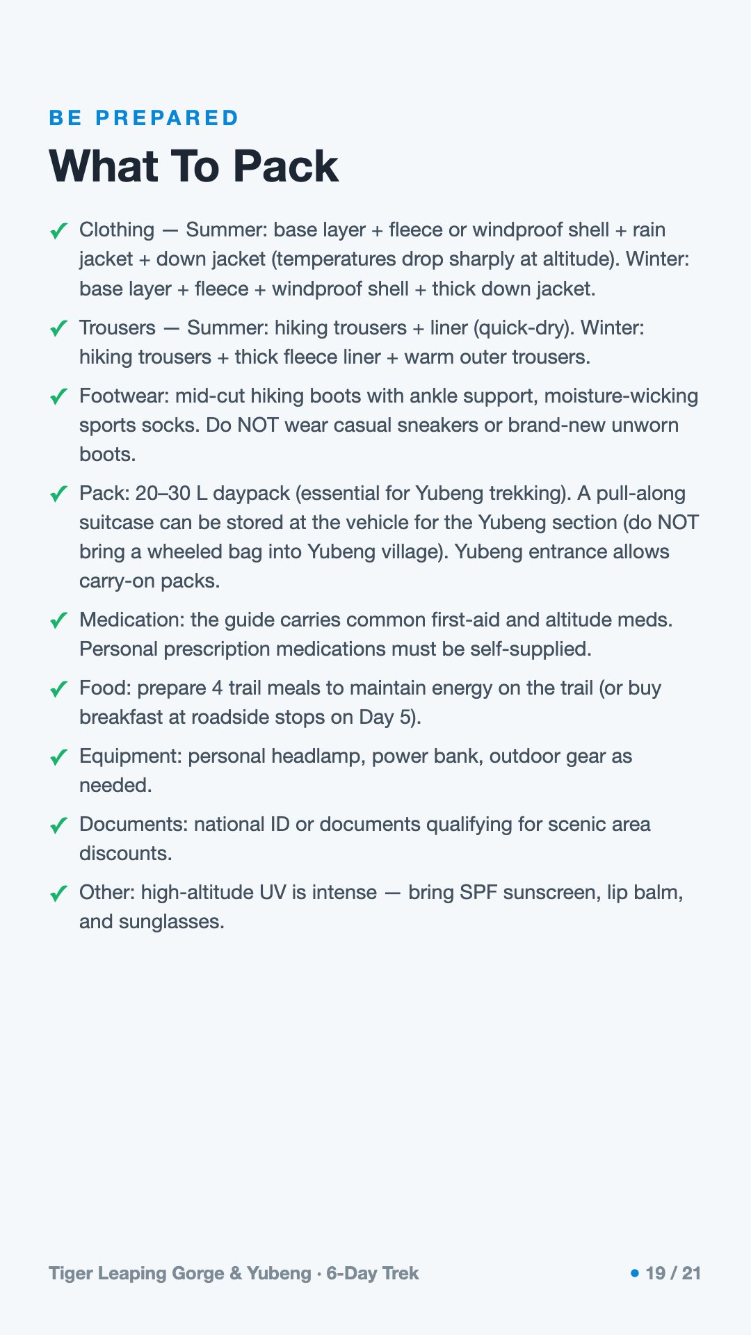
Key items: Clothing in summer: a base layer plus a fleece or windproof shell, a rain jacket and a down jacket, as temperatures drop sharply at altitude., Clothing in winter: a base layer, a fleece, a windproof shell and a thick down jacket., Trousers in summer: hiking trousers with a quick-dry liner. In winter: hiking trousers with a thick fleece liner and warm outer trousers., Footwear: mid-cut hiking boots with ankle support and moisture-wicking sports socks. Do not walk in casual trainers or in brand-new, unworn boots., A 20–30 L daypack, which is essential for the Yubeng trekking days., A pull-along suitcase can be left in the vehicle for the Yubeng section; do not bring a wheeled bag into Yubeng village, though the Yubeng entrance does allow carry-on packs., Personal prescription medication, which you must supply yourself; the guide carries common first-aid supplies and altitude medication., Four trail meals to keep your energy up on the trail, or buy breakfast at the roadside stops on Day 5..
Operated by an independent, licensed local mountain operator in Yunnan. Inglite connects you and supports you in English the whole way; you arrange payment with the operator directly.
Run by an independent, licensed local operator. You arrange payment with the operator directly — Inglite connects you and never collects payment. Outdoor travel carries inherent risks; travel insurance with high-altitude and evacuation cover is required. Booking & refunds · Terms
— or send a request below —
✅ Request received! Reference
We reply within 24h. Fastest: message us on WhatsApp and mention your reference.
Chat on WhatsAppThe climb out of the river into Yubeng quiets people. This is a trek through northwest Yunnan: about six days of walking and driving that carries you from the golden dawn of Kawagebo, the highest peak in Yunnan, down to a milky stretch of the Mekong and up into a Tibetan valley pinned beneath glaciers. It is a moderate route — call it a three out of five — with two big day climbs from the village: one to a glacial Ice Lake near 3,900 meters, one to a Sacred Waterfall the pilgrims walk under to wash away their sins. You don't need to be a mountaineer, but you do need honest legs and a head that takes altitude seriously. The route runs in spring (March to June) and autumn (September to November), when the passes are open and the great snow peak is most likely to show its face. What draws people here is not conquest. Above this valley sits a summit no human has ever stood on — and never should.
Standing in Yubeng, you are inside one of the most dramatic pieces of geography on Earth. Above the village rises Kawagebo — also spelled Khawa Karpo — at about 6,740 meters the highest peak in Yunnan and the crown of the Meili Snow Mountain range, a wall of more than twenty permanently snow-capped summits, six of them above 6,000 meters. What makes Kawagebo extraordinary is not only its height but that no human has ever stood on top of it. It is among the holiest mountains in Tibetan Buddhism, believed to be the dwelling of a warrior god, and climbing it is now forbidden outright. Each year tens of thousands of pilgrims instead walk a long circuit around it; Yubeng sits directly on that sacred road.
This whole landscape lies within the Three Parallel Rivers of Yunnan Protected Areas, a UNESCO World Natural Heritage Site inscribed in 2003 (its boundaries later slightly adjusted). The name is literal: three of Asia's great rivers — the Nujiang, which becomes the Salween; the Lancang, which becomes the Mekong; and the Jinsha, the upper Yangtze — run side by side, north to south, through the Hengduan Mountains, carved into gorges up to roughly 3,000 meters deep and divided by ridges in places only some tens of kilometers wide. UNESCO calls it possibly the most biologically diverse temperate region on the planet, with around 6,000 plant species packed into the steep climb from warm river valley to glacier.
You can read that diversity in a single day's walk. Dry subtropical scrub in the valley gives way to broadleaf and then conifer forest, then rhododendron, alpine meadow, bare scree and moraine, and finally permanent snow — nearly 6,000 vertical meters of life zones stacked on one mountainside. Two short treks from the village reach the heart of it: the Ice Lake trail climbs to a glacial tarn around 3,900 meters directly beneath Kawagebo's ice, and the Sacred Waterfall path rises to about 3,600 meters. Lower down the same massif, the Mingyong Glacier tumbles off Kawagebo's flank all the way down to roughly 2,700 meters — China's lowest-latitude and lowest-elevation glacier, a river of ice fed by monsoon snow that, like glaciers across the region, has been visibly retreating in recent decades.
The history of this mountain comes down to one sentence: the peak you are circling has never been climbed, and it is guarded by both law and faith.
In the winter of 1990–91, a joint Chinese-Japanese expedition came to attempt it — eleven climbers from the Japanese side, six from the Chinese Mountaineering Association. On the night of January 3rd, 1991, an avalanche struck their high camp on the upper Mingyong Glacier. By the following morning, base camp could no longer raise anyone above. All seventeen members were lost. It remains one of the deadliest accidents in the history of mountaineering. Local Tibetans had opposed the climb from the start; to them, setting foot on the summit was an offense against the warrior god who guards these valleys.
The story had a long echo. Years later, the melting glacier gave the climbers back: from 1998 onward, herders began finding gear, and in 1999, sixteen of the seventeen bodies were recovered from the Mingyong Glacier at roughly 3,700 to 3,800 meters. One man, the expedition's doctor, has never been found. In 2001, the local government in Deqin made it law, banning all climbing of Kawagebo on religious and cultural grounds. So it became one of the very few high peaks on Earth that is permanently closed by faith — and still unclimbed.
Yubeng itself is a kind of living history of isolation. At around 3,050 meters, tucked beneath the range, for centuries it could be reached only on foot or by mule, over a pass near 3,700 meters. Only in recent years did a rough mountain track reach it. And the wider region was once the throat of the Tea Horse Road into Tibet, where caravans hauled tea over countless passes above 3,000 meters — the land you are standing on when you first set down your pack in the valley.
When you stand at Feilai Temple at dawn and watch first light reach Kawagebo, it is worth holding on to what this mountain actually is to the people whose home this is. To them it is not a summit. It is a god — the earthly body of a warrior protector deity who rides a white horse, worshipped in these valleys long before Buddhism arrived and later honored as a defender of the faith. That is why no one has ever stood on its peak, and why no one ever should. Many people here understood the 1991 avalanche as the mountain answering disrespect. Walk this valley knowing the silence above you is deliberate and protected — not an unfinished challenge.
The way you honor this mountain is not to climb it but to walk around it. Pilgrims have circled Kawagebo for centuries. There is an inner kora threading the sacred places of Deqin County — past Feilai Temple, the Yubeng Sacred Waterfall, and the temples between — and a far longer outer circuit over high passes that traditionally takes weeks on foot. The most charged years are Years of the Sheep, the deity's own zodiac year, when the merit of the round multiplies. Each spring and autumn, families still come from Yunnan, Tibet, Sichuan, Qinghai and Gansu to make it.
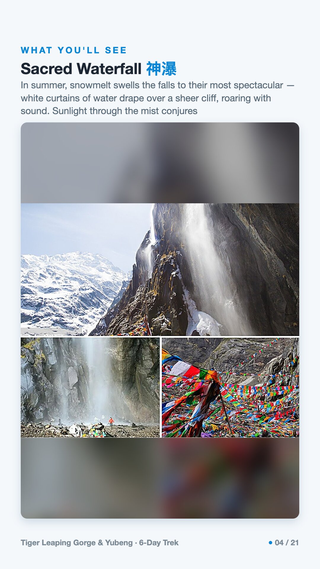
The Sacred Waterfall above Yubeng is one of the holiest points on the inner route. Its water is glacial meltwater straight off Kawagebo — holy water — and pilgrims pass clockwise beneath the spray three times, letting the cold fall over them to cleanse body and soul, something many hope to do once in a lifetime. When you reach it, keep quiet and keep to the edges. This is a working shrine, not a backdrop.
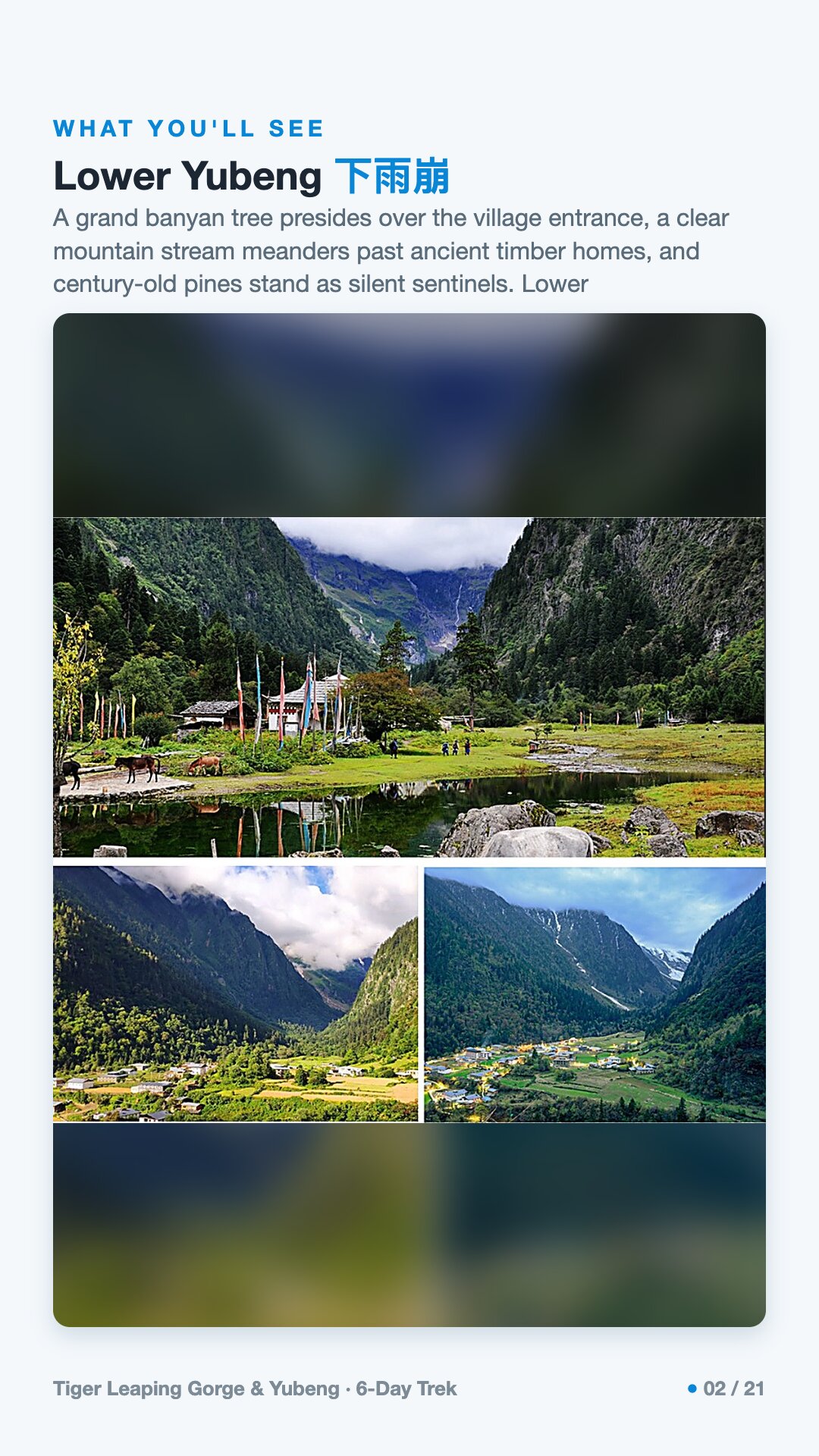
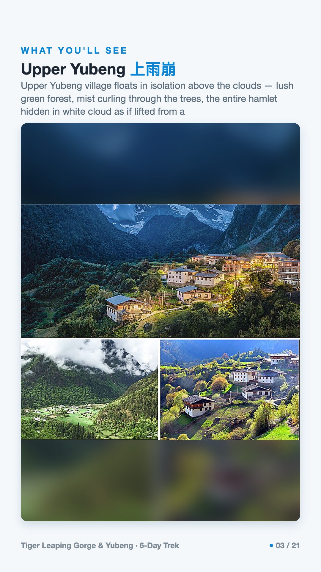
Yubeng itself — Upper and Lower, around 3,000 meters at the foot of the range — is a small Khampa Tibetan village that for generations lived on barley, potatoes, yaks and timber. Today most families run guesthouses and rent horses and mules to trekkers, and they share that work fairly by village custom, even drawing lots for which animal carries which guest. But their bond to the mountain was never about visitors. Kawagebo is their protector, and old taboos against hunting and logging still guard its forests and springs. So walk clockwise around the stupas and mani walls, don't move the carved stones, ask before you photograph a face or a prayer, and treat the whole valley the way the people here do — as the body of a god who lets you pass through.
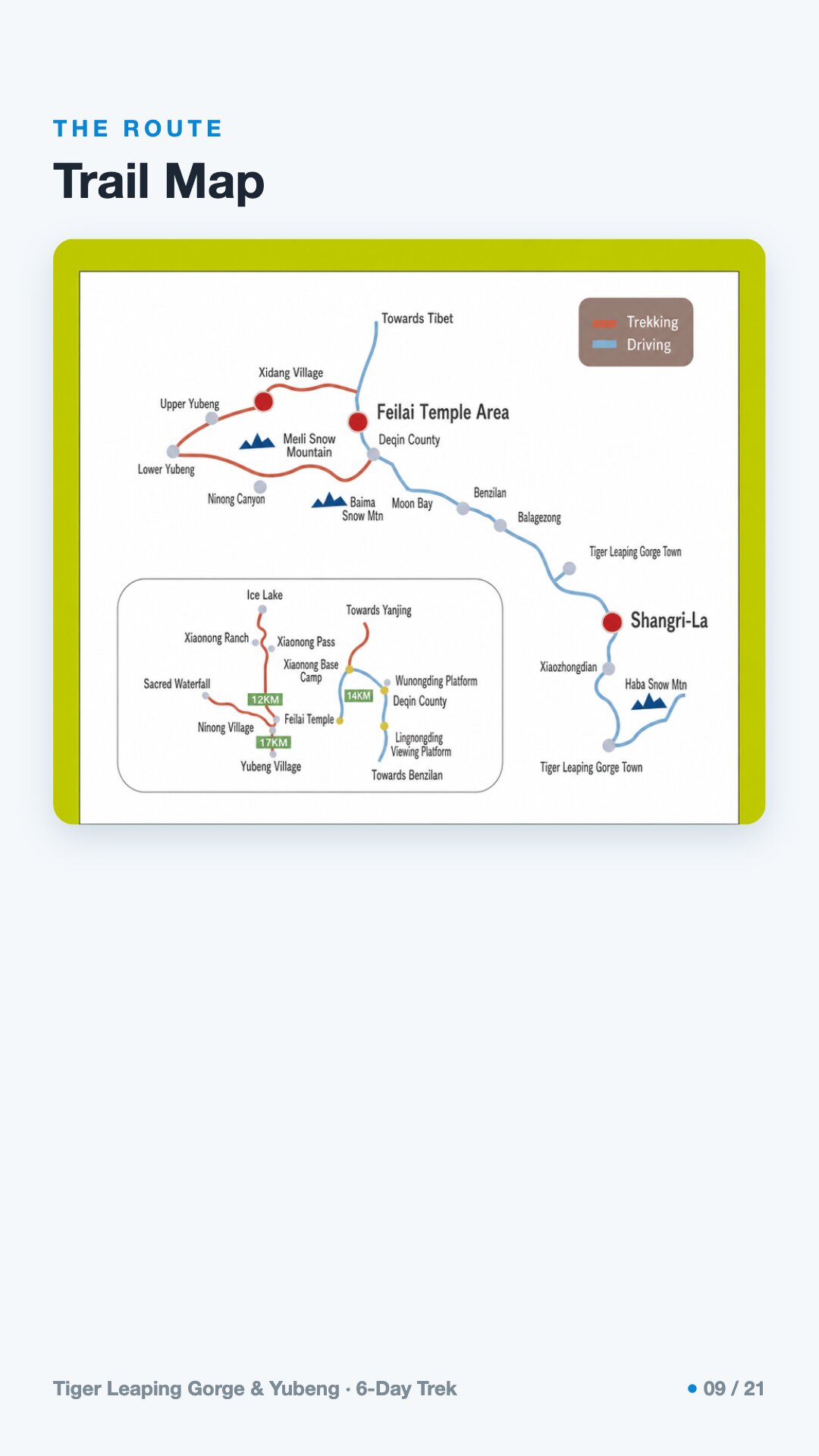
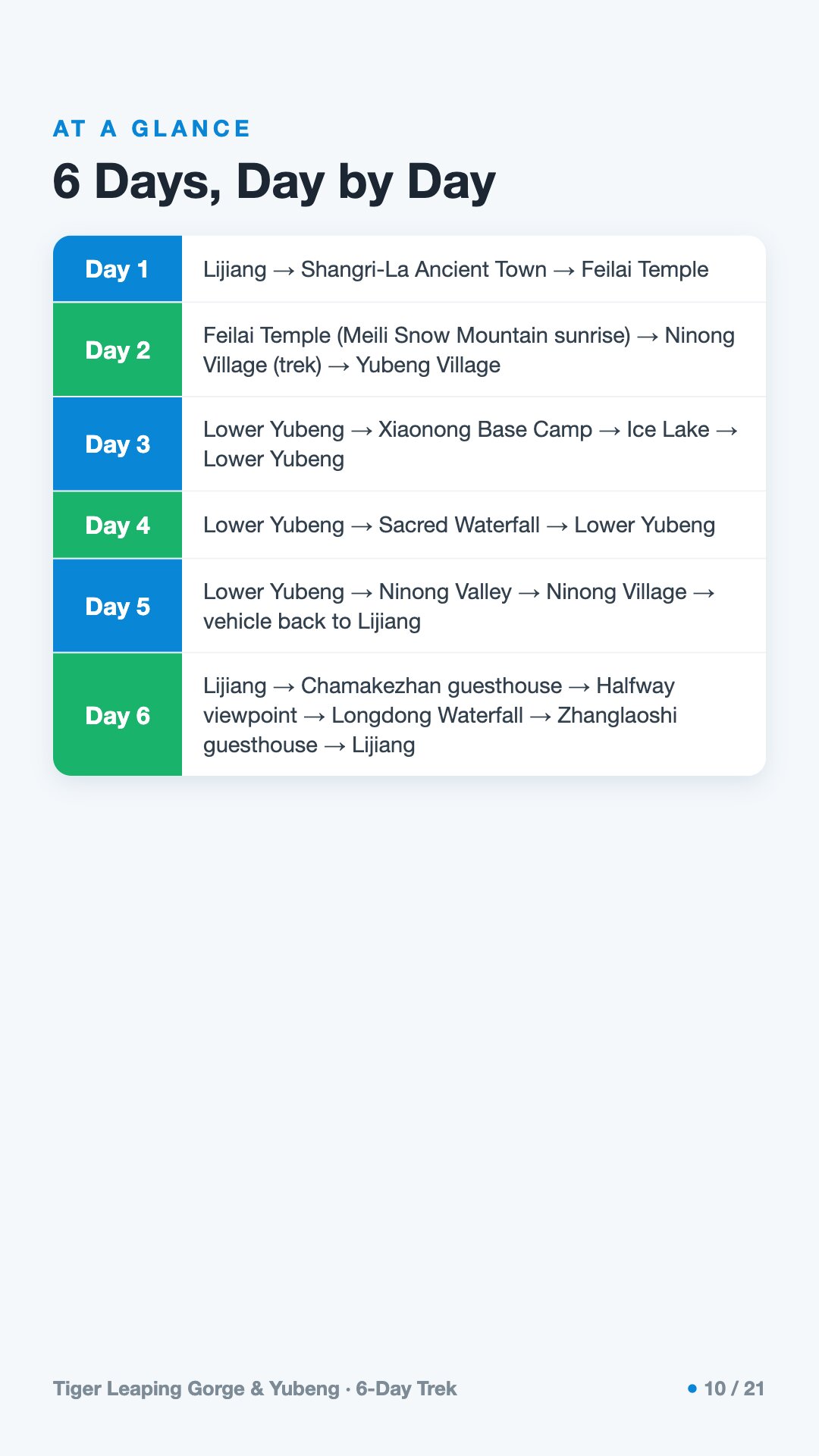
The walking here is simpler than the geography sounds. It is essentially one path, well-trodden, with company on the trail, and the real difficulty is altitude and the length of the two big village days rather than any technical ground. The rhythm is the pleasure of it: a slow drive that lifts you into thinner air, then a hard climb into the valley, then two days reaching toward the ice, a gentle day out, and finally a contrasting taster of Tiger Leaping Gorge to end on. Here is how the six days unfold.
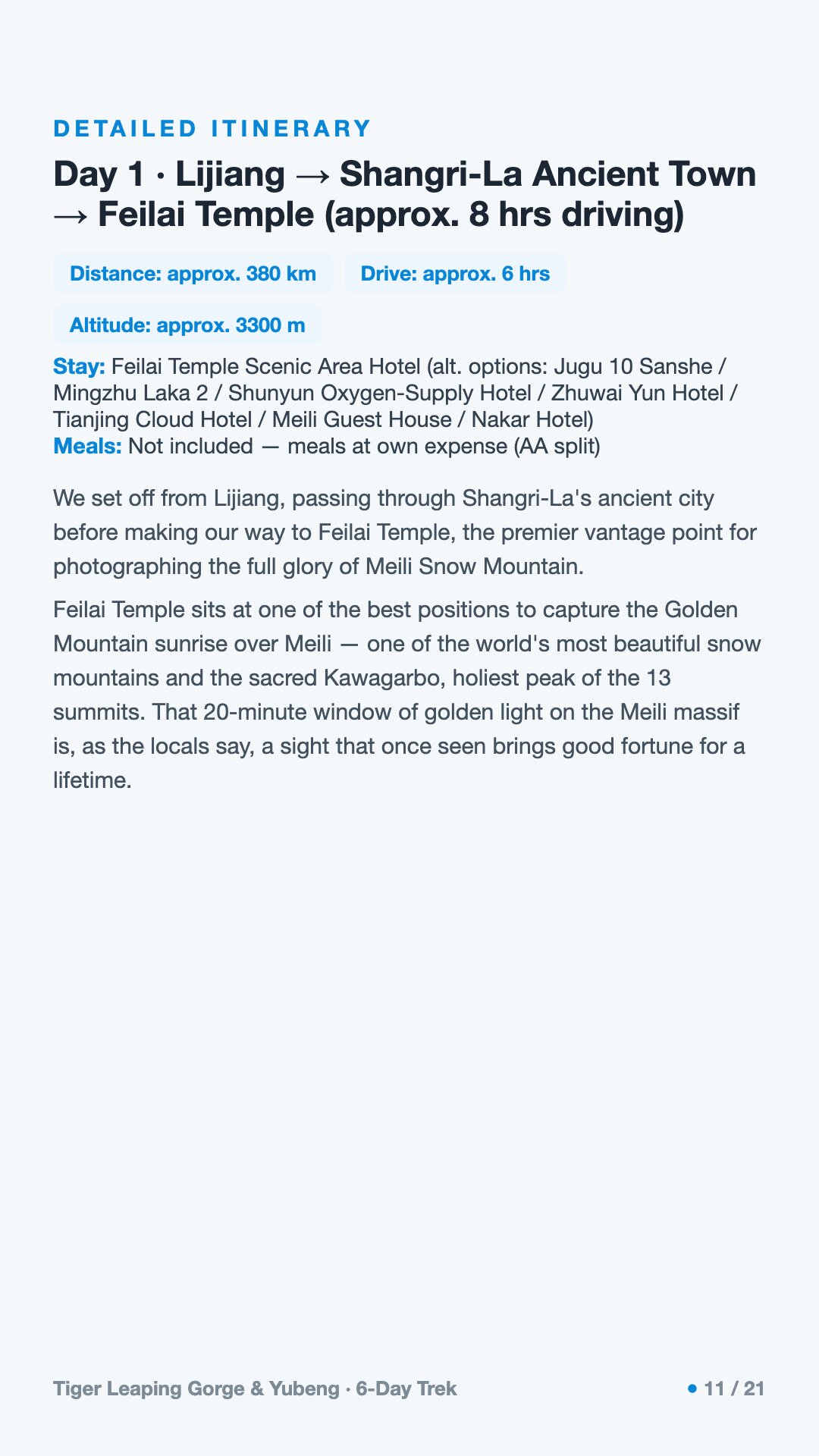
The drive does quiet work on your body. Lijiang sits around 2,400 meters, Shangri-La around 3,200, and Feilai Temple around 3,450 — exactly the acclimatization ladder you want before the trek begins. Feilaisi is a row of guesthouses on a ridge above the Lancang canyon, every balcony aimed straight at Kawagebo. You are here for one thing: the dawn Rizhaojinshan, when first light turns the snow pyramid molten gold for ten or twenty minutes. Be warned: it is elusive. Clouds hide the peak most mornings; locals say catching it buys a year of luck, and you may need more than one dawn. In spring the light comes around 6:30 to 7:00, later in autumn and winter. You watch this mountain. You do not summit it.
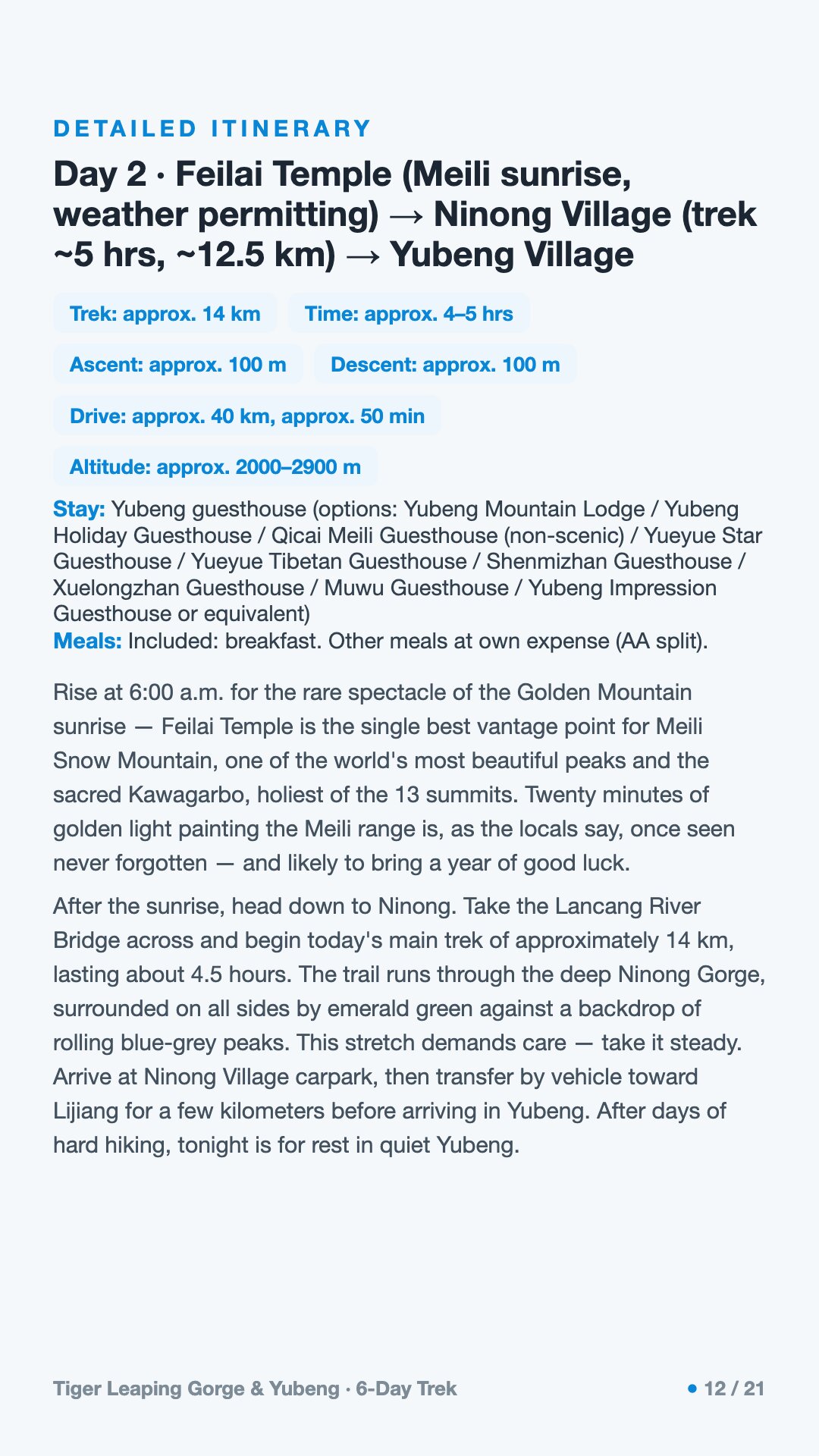
The old Xidang trailhead is closed now, so everyone enters via Ninong. The day starts with a drive down to the river, and then comes the route's single biggest climb — roughly a thousand meters of gain over a long morning and afternoon. It opens honestly with switchbacks straight up out of the valley (the view back over Ninong is your reward), then a flatter traverse along the milky Mekong, before the trail turns hard west into the Yubeng gorge and climbs steeply, often muddy, to the village. Mules and rugged vehicles can carry you or your bag if the legs give out. You arrive at a twin hamlet — Lower and Upper Yubeng — Tibetan houses under glaciers, simple guesthouses with heaters and hot showers, dorm beds around 40 RMB, and balconies framing Meili.
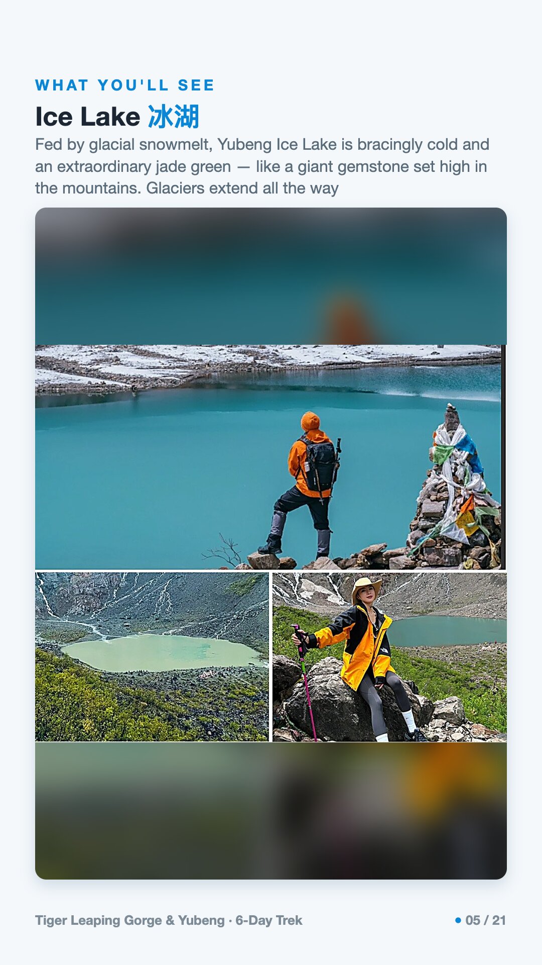
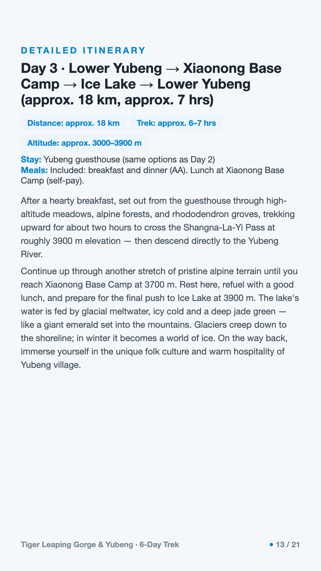
This is the hardest, highest day: a long round trip with several hundred meters of climbing through old-growth fir and rhododendron, over a river bridge, up to a col around 3,623 meters, then down to a pasture base camp near the old Meili climbing camp, where a couple of stalls sell food. A final steep stretch brings you to an emerald glacial lake fed by waterfalls off the ice, directly beneath Kawagebo. Above roughly 3,600 meters there is often snow and ice well into spring — micro-spikes help, and the trail genuinely closes on unsafe-snow days. This is where altitude bites if it is going to. Pace, rest, drink.
A gentler day, partly paved, climbing through forest lined with prayer flags into an alpine cirque, past a meditation cave and inscribed pilgrim rocks, ending on a steep stair to the falls. Pilgrims circle and walk beneath the spray for blessing; depending on the season it is a thundering cascade or a frozen mist. After the effort of the Ice Lake, this is the quieter, more spiritual day — the one people most often remember afterward.
Mostly downhill, on a narrower river-trail that many walkers prefer to the way in. It passes a side-gorge waterfall and a dramatic stretch high above the Mekong that feels like a miniature Tiger Leaping Gorge. The final scree switchbacks down to Ninong need care — tired knees make mistakes here. Then it is the long road back toward Lijiang.
A taster of the famous High Trail and its 28 Bends, a switchbacking climb of a few hundred meters from a trailhead near 1,800 meters, usually staged from a Naxi guesthouse. The full High Trail is classically a two-day trek; this day covers a single, generous section of it — enough to feel the scale of one of the deepest gorges in the world, and a fine contrast to the sacred valley you've just left.
Do I need prior trekking experience? No, but you need reasonable fitness and respect for altitude. The two village days — the climb in and the Ice Lake — are long, and one reaches nearly 3,900 meters. If you walk regularly and acclimatize on the way up, you'll manage.
What is the altitude profile, and how do I handle it? You sleep around 3,450 meters at Feilaisi and around 3,050 in Yubeng, with day trips to about 3,600 and 3,900 meters. The staged drive helps, but go slowly, drink plenty of water, and tell your guide early if you feel unwell. Descending even a few hundred meters is the most reliable cure.
Can mules or vehicles carry me or my bag? Yes. On the climb into Yubeng, mules and rugged shuttle vehicles can carry packs or tired trekkers. Note that the road to Yubeng is a rough shuttle track served by local off-road vehicles, not an ordinary drive-in highway, and many people still choose to walk in.
Will I actually see the golden sunrise on Kawagebo? Maybe. The peak is often wrapped in cloud, and it can hide for several mornings in a row. Locals say catching the Rizhaojinshan brings a year of luck — which tells you how rare it can feel. Building in more than one dawn at Feilaisi improves your odds.
Is it appropriate to visit the Sacred Waterfall as a non-pilgrim? Yes, respectfully. It is a living shrine. Walk clockwise, keep to the edges, stay quiet, don't disturb prayer flags or carved stones, and ask before photographing people at worship. You are a guest on a sacred path.
How do payments and language work on the ground? Cash is awkward; most transactions run through WeChat or Alipay, which are hard to set up on a foreign phone. There is little to no English in the village or on local transport apps. This is the practical reason English-speaking local support smooths the trip far more than it does the actual walking.