Daocheng Yading, Sichuan · 9 days / 8 nights · Challenging (4.5/5) · max ~5,036 m (Cuogaida Pass) · $200/day · $1,800 total per person
Walk the full sacred circle around Yading's three holy peaks.
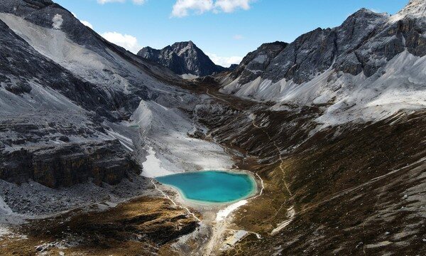
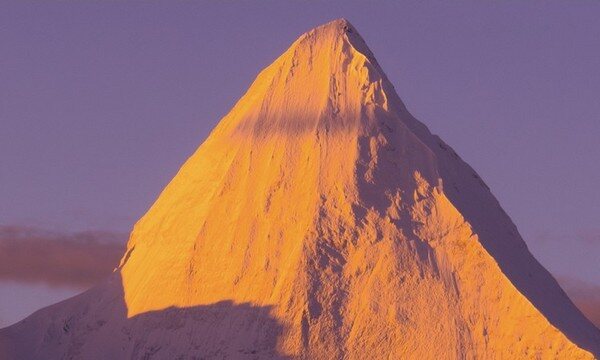
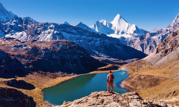
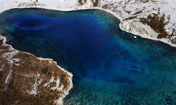
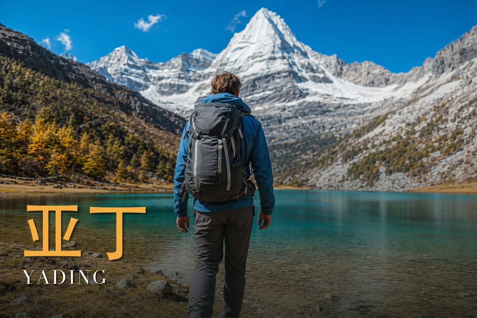
In Tibetan Buddhist tradition, to circumambulate the three guardian snow peaks of Yading is to fulfil the wishes of this life and the next — a single Grand Kora is said to carry the merit of reciting a hundred million mantras. Where most visitors glimpse Yading from a shuttle bus, this nine-day trek walks the complete outer ring, a full 360 degrees around the three holy mountains, on a route that stitches together the finest sections of the classic Joseph Rock, Luhuo–Yading and Niru–Yading lines.\n\nThe three peaks stand in a near-perfect triangle, each independent yet bound to the others, and each named for a bodhisattva: Xiannairi (6,032 m) to the north, the embodiment of Avalokiteshvara; Yangmaiyong (Jambeyang, 5,958 m) to the south, Manjushri; and Chanadorje (Xianuoduoji, 5,958 m) to the east, Vajrapani. Their collective Tibetan name, Gongga Risong Gongbu, means \"the holy land of three guardian snow mountains, snow-clad year round\" — said to have been consecrated by Padmasambhava himself in the 8th century, and ranked the eleventh of the world's twenty-four sacred sites.\n\nFrom Chonggu Temple inside the Yading scenic area, the trail climbs past a string of names that read like a litany of the high Tibetan world: Boyong Lake beneath the peaks, the soaring 5,036 m Cuogaida Pass, the lonely Niang Lake wreathed in cloud, Gongga Zhaze and Zhabala passes, the jade-black waters of Black Lake, the serpentine Snake Lake set below a 4,730 m col, and the famous trio of Milk Lake, Five-Color Lake and Pearl Lake on the descent home. Cumulative ascent runs to roughly 3,900 m, with the route swinging between 3,990 m and a high point of 5,036 m.\n\nDay 2 leaves the road behind, riding the shuttle some 50 minutes to Chonggu Temple before climbing through the scenic boardwalk to the Gate of Holy Water, then turning off into primeval forest. Emerging above the treeline, the three holy peaks reveal themselves in full, and the day ends camped at the Boyong Lake meadow (7 km, +760 m, about 4 hours).\n\nDay 3 is a free day at Boyong Lake — the most exquisite corner of the whole circuit. A scramble up the ridge behind camp opens a view that takes in all three Yading peaks, distant Gongga (the King of Sichuan) and even Yunnan's Meili Snow Mountain, while the lakeshore is among the finest places anywhere for star fields, mirror reflections and golden first light on the peaks.\n\nDay 4 is the big crossing: roughly two hours up to the 5,036 m Cuogaida Pass, then a long descent past Cuogaida Lake and the misty Niang Lake viewpoint to Galuo cattle farm, and on through forest along the White Water River to the Gongga Zhaze camp (16 km, +300 m, −940 m, about 8 hours) — the closest point on the route to Chanadorje.\n\nThe middle days trace the high contour. Day 5 crosses a traverse pass beneath Chanadorje, running parallel to and above the Joseph Rock line, to camp below Zhabala Pass (7 km, about 5 hours). Day 6 climbs the steep haul over Zhabala Pass (4,750 m) and descends past Niangxi cattle farm to Xinguo camp at the southwest foot of Jambeyang (9 km, about 5 hours). Day 7 threads several small passes and slide zones to the 4,720 m Black Lake Pass — the turning point around Jambeyang — past the landmark \"Butterfly Stone\" and over the Snake Lake Pass (4,730 m) to camp beside the still, jade waters of Snake Lake (11 km, about 6 hours).\n\nDay 8 crosses the 4,670 m Songduo Pass into the heart of the scenic area to visit Milk Lake and Five-Color Lake, with an optional climb to the 4,770 m double-lake viewpoint, then follows Avalokiteshvara's shorter kora down past Resong Lake to camp at Kasi cattle shed (12 km, about 7 hours). Day 9 climbs the flank of Avalokiteshvara's peak above the dramatic Kasi Hell Valley to Songluo Pass (4,650 m), the most prayer-flag-laden col of the trip and the gateway from the valley into Yading's paradise, before a long forested descent to Pearl Lake and the boardwalk back to Chonggu Temple — the close of the Grand Kora — and the drive back to Daocheng (11 km, +250 m, −660 m, about 6 hours).
Yading Grand Kora runs 9 days / 8 nights.
It's rated Challenging (4.5/5), topping out around ~5,036 m (Cuogaida Pass). Reasonable hiking fitness and time to acclimatize to altitude are recommended.
The high point is around ~5,036 m (Cuogaida Pass). Acclimatize gradually and take altitude-sickness precautions — consult your doctor before any high-altitude trek.
The best seasons are Autumn (late September to early November) for clear skies and golden larch and meadow colour.
English-speaking guide on request · or local guide + Inglite app for English support It's run by an independent, licensed local mountain operator, with Inglite supporting you in English the whole way.
Approximately $1800 per person ($200/day · $1,800 total). You arrange payment directly with the licensed local operator — Inglite never collects payment.
This Grand Kora is operated by an experienced licensed local mountain outfitter, with a certified guide team, high-altitude cook and full camp logistics on the ground throughout. English-language support is provided via the Inglite app and your guide, so you can focus on the walking and the peaks.
Run by an independent, licensed local operator. You arrange payment with the operator directly — Inglite connects you and never collects payment. Outdoor travel carries inherent risks; travel insurance with high-altitude and evacuation cover is required. Booking & refunds · Terms
— or send a request below —
✅ Request received! Reference
We reply within 24h. Fastest: message us on WhatsApp and mention your reference.
Chat on WhatsAppI came to Daocheng for a clean autumn sky and stayed for the silence between the passes. The Grand Kora is a nine-day, high-altitude circle around three sacred snow peaks in western Sichuan — a pilgrimage route, not a sightseeing loop, and an honestly hard one (I'd call it 4.5 out of 5). For days you live above 4,000 metres, cresting prayer-flag passes, threading glacier-fed lakes, and waking to cold alpenglow on the snow. What moves me isn't the difficulty; it's the devotion written into the land — herders' cairns, wind-shredded flags, the same path walked for centuries to wash away a lifetime's failings. Come in autumn, late September into early November, when the larches turn to gold and the skies finally clear. Walk it slowly. Let the altitude teach you patience.
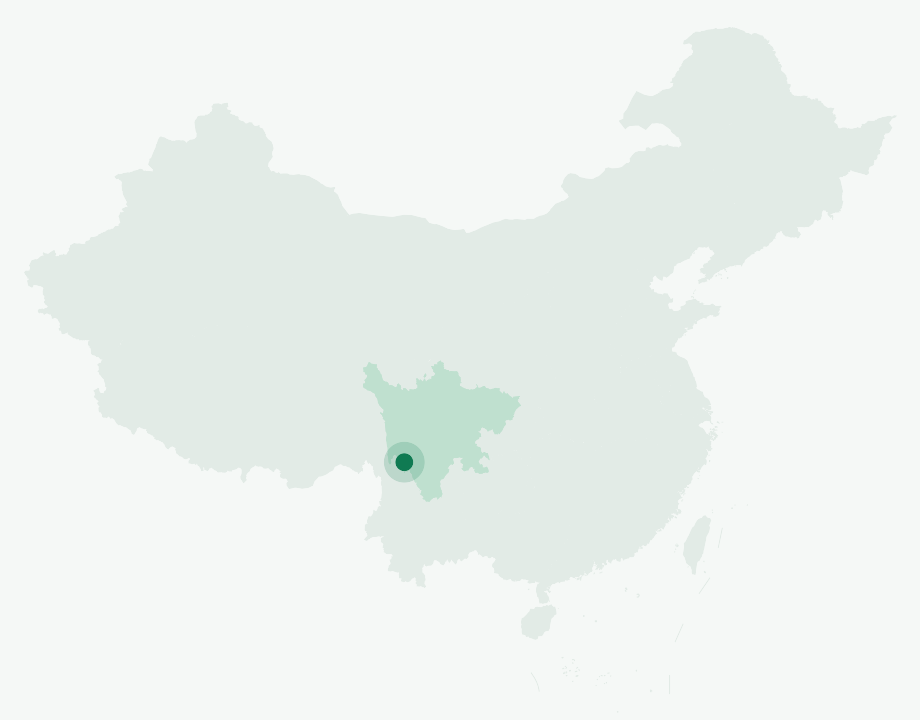
Yading sits in Daocheng County, in the Garze (Ganzi) Tibetan Autonomous Prefecture of southwestern Sichuan — on the wild eastern rim of the Qinghai-Tibet Plateau, deep in the folded ranges of the Hengduan Mountains, near 28.37°N, 100.23°E. Its Tibetan name is Nyidên. This is one of China's most intact alpine wildernesses, protected as a UNESCO Man and Biosphere reserve since 2003, covering roughly 1,300 to 1,460 square kilometres and climbing from valley floors well below the tree line to the 6,032-metre summit of the highest peak.
The land is written by ice. The core holds glaciers and glacier-fed lakes, and the wider massif is studded with high ground — by one mountain survey, dozens of peaks rise above 4,500 metres and ten clear 5,000. The kora threads past the famous lakes: Pearl Lake below Chenrezig, milky-turquoise Milk Lake at roughly 4,400 metres, and the Five-Color Lake just above it (lake elevations wander a little depending on who you ask, so I keep them approximate). Above the water stands the signature vegetation of this corner of the plateau — larch that ignites gold in autumn, and rhododendron that burns in early summer. The reserve shelters more than a thousand vascular plant species and close to three hundred vertebrates.
Three summits stand here in a great triangle, known together as Konka Risumgongba, each held to be the living form of a bodhisattva: Chenrezig (Xiannairi), the highest at 6,032 metres; Jampelyang (Yangmaiyong), just under 6,000 metres; and Chanadorje (Xianuoduoji), of similar height. These peaks were sanctified by the 5th Dalai Lama in the 17th century, and Chonggu Monastery, at the inner gateway, was rebuilt by one of his disciples.
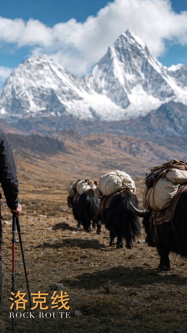
To the outside world the mountains were almost a rumour until 1928, when the Austrian-American botanist Joseph Rock pushed in from the kingdom of Muli, guided through bandit country, and came back with photographs no Westerner had taken before. His National Geographic article of July 1931 — "Konka Risumgongba, Holy Mountain of the Outlaws" — put this place on the map, and the route I'm tracing is still nicknamed after him. The same era's dream of a hidden mountain paradise eventually gave the gateway its modern name: the town of Riwa was rechristened Shangri-La Town.
This is Khampa (Kangba) Tibetan country, and Khampa families make up the large majority of the people who live and herd here. Their lives turn on yak and cattle, on summer pasture and winter shed, and the place names along the kora — Galuo, Gongga Zhaze, Niangxi, Xinguo — are the names of working herder camps, not waypoints invented for trekkers.
To walk a kora is to circle a holy place clockwise, one of the deepest acts of Tibetan devotion. The inner kora circles Chenrezig alone; the grand kora — the one I'm walking — encircles all three peaks. A single circuit is said to wash away the failings of a lifetime, and for centuries pilgrims and herders have come on foot to do exactly that. I walk it as a guest in someone else's act of faith: I keep to the clockwise direction, I don't climb on the cairns or the mani stones, and I treat the passes, with their snapping prayer flags, as the thresholds they're meant to be. The mountains aren't scenery to the people here. They're alive.
The rhythm of the Grand Kora is patient and high. You start low in the Daocheng valley, climb hard into a world that stays above 4,000 metres for days, and only descend at the very end. Mornings are cold and bright; afternoons can turn fast. You measure progress not in kilometres but in passes crossed and lakes counted, and you let the thin air set the pace.
We meet in the gateway town at around 2,900 metres. The day is for arriving slowly, sorting gear, and beginning to feel the altitude — nothing strenuous, by design.
We pass Chonggu Monastery at the inner gateway near 3,990 metres, then climb steeply to our first high camp at Boyong Lake, around 4,750 metres. The jump in elevation is real, and you feel every metre of it by dusk.
A deliberate rest and acclimatization day at the lake. We move gently, stay hydrated, and let our bodies catch up before the highest crossing of the whole route.
The big day. We top out at the Cuogaida Pass near 5,036 metres — the high point of the entire kora — with prayer flags streaming, then drop past Niang Lake and the Galuo herder farm to camp at Gongga Zhaze, around 4,100 metres.
We traverse beneath Chanadorje, the Buddha of power, crossing a pass near 4,500 metres, and camp at roughly 4,400 metres in the shadow of the next climb.
Over the Zhabala Pass at about 4,750 metres, then down through the Niangxi farm to a herders' camp at Xinguo, around 4,300 metres, where cattle graze the high meadow.
A double-pass day — Black Lake Pass near 4,720 metres, then the Snake Lake Pass at about 4,730 metres — past the curious Butterfly Stone, to camp by Snake Lake around 4,500 metres.
Over the Songduo Pass near 4,670 metres into the day of lakes: the Five-Color Lake, milky-turquoise Milk Lake, and Resong Lake, before camping at the Kasi cattle shed, about 4,400 metres. For many trekkers this is the most beautiful stretch of the whole circle.
The closing of the circle. We cross the Songluo Pass at around 4,650 metres, descend past Pearl Lake below Chenrezig, return to Chonggu Monastery at 3,990 metres, and drop back to Daocheng — the kora complete.
How fit do I need to be? Fit enough to walk long days at altitude on rough ground, carrying a daypack, day after day, with multiple high-pass crossings. Prior multi-day trekking experience and serious training beforehand will make this far more enjoyable than enduring.
How bad is the altitude, really? Real enough to take seriously. You live above 4,000 metres for most of the trek and top out above 5,000. The built-in rest day at Boyong Lake helps, but everyone responds differently — drink constantly, walk slowly, and tell your guide immediately if you feel headache, nausea, or breathlessness that won't settle.
Where do we sleep? In camps along the kora, several of them at working herder sites between roughly 4,100 and 4,750 metres. Nights are cold even in autumn, so a warm sleeping system matters.
What's the food and water situation? Meals are prepared along the way, and water comes from the mountains; this is remote country with no shops between the gateway and the finish, so you carry what you need and rely on the team for the rest.
Will it actually be sunny and golden? Autumn is the most reliable window for clear skies and golden larch, which is exactly why it's the recommended season — but these are high mountains, and weather can still turn. Build in flexibility and don't bank on a perfect forecast.
Is this a religious site I should be careful in? Yes. The peaks are sacred and the kora is an act of devotion. Walk clockwise, don't disturb cairns, mani stones, or prayer flags, ask before photographing people, and move through the passes with the respect they're given by those who have walked here for generations.